Is there an accurate list of the highest resolution terrain areas and extents of them for MSFS 2024?
1 Like
Hi @Sonicviz
If you are referring to photogrammetry, have a look at this topic:
If you are referring to DEM
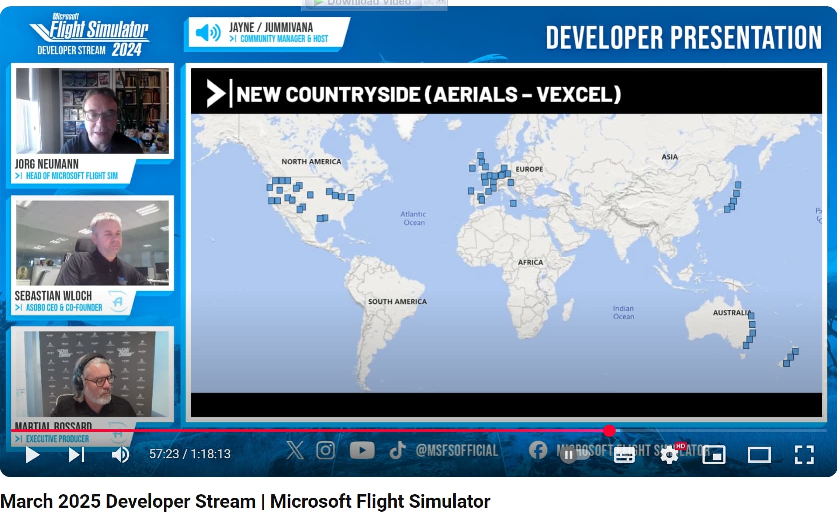
There is no published master list or complete world map, AFAIK, though there have been maps shown for various regions, e.g. as mentioned in this wishlist item:
2 Likes
Thanks. I was referring to DEM/VEXCEL areas specifically, so your second link is closest.
There’s noticeably a few, but would be nice to have an actual list.
I’m sure it’s not secret as we’re actually looking at the results in sim, but would be nice to have a guide so we didn’t have to hunt n’ peck to find the current good bits.
4 Likes
I guess you remember that Developer Stream .
The scenery in that regions is awesome !!
Good luck, walter.
2 Likes
Thanks. Be great if they could give us more accurate data though. Those are large areas.
3 Likes
Still nothing. A digital twin of earth with no definitive guide to the highest resolution locations. ![]()
Instead we get to randomly poke a pin in the world map to see if we can hit something nice.
i made a post about this too a while back. there is a great US map but for some reason they didn’t do one for the other WU areas. the devs know the answer to this stuff, but for some reason don’t want to share.
i also would love to fly in high-DEM areas. One of my favorite is Queenstown, NZ. It is amazing and how I wish the rest of the world was.
anyway, check this US map out: Map of whole world showing the DEM LOD (elevation data quality) used by MSFS - Official Microsoft Flight Simulator / Wishlist - Microsoft Flight Simulator Forums
1 Like
Thanks, but that was already referenced in the 2nd post above by @SmotheryVase665 Highest Resolution Terrain List - #2 by SmotheryVase665 and also I referred to it here Highest Resolution Terrain List - #3 by Sonicviz