Currently, the only way to obtain weather and terrain radar is through the BingMap JS interface, which only renders a static image that can barely be customized at all (and only cosmetic customizations). Therefore, this means that high fidelity third party aircraft are severely limited by the lack of a native SDK API for retrieving weather, terrain, wind, and METAR data.
Please implement this API functionality in the sim as soon as possible, as it is a huge blocker for practically every third party aircraft developer, and there are no possible workarounds.
I already posted this in the developer forum, however I will copy over the details of this feature request:
Add weather API functions for WASM and JS gauges which can accomplish the following:
- Return precipitation data over a defined area, in multiple customizable layers (dependent on severity), so that custom weather radars can be implemented by third party developers
- Return wind/windshear data over a defined area, so that custom predictive windshear systems can be
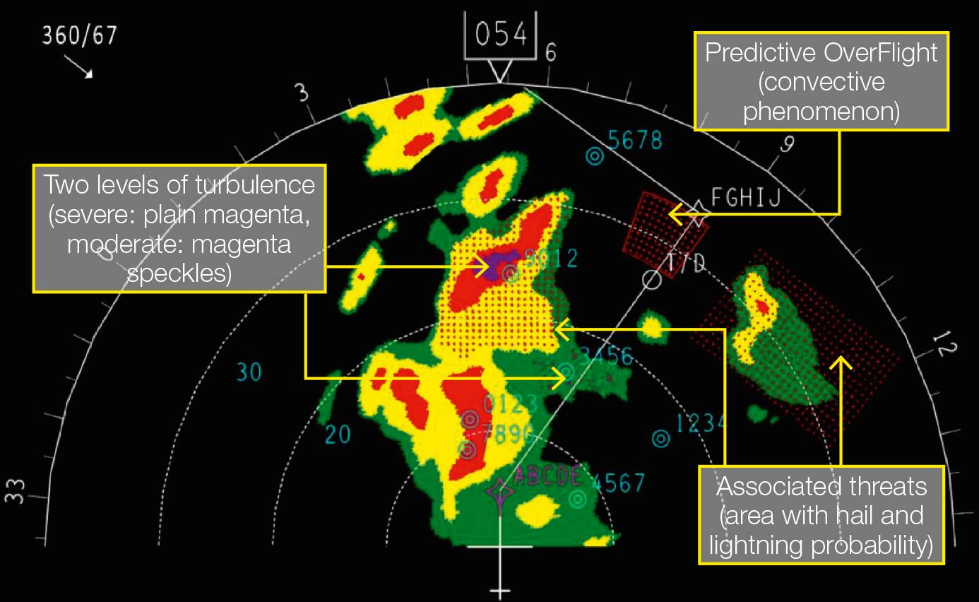
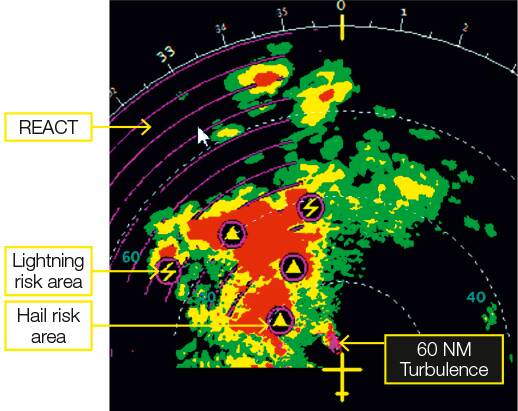
- Return turbulence data over a defined area, in multiple customizable layers (dependent on severity - e.g. A320 weather radar displays turbulence in 2 layers: moderate and severe), so that it can be incorporated into custom weather radars
- Return hazard data over a defined area (returning distinct location(s) of possible lightning and hail) so that it can be incorporated into custom weather radars
- Create an API which allows for retrieving weather data (especially temperature, pressure, and current winds) at any given waypoint, facility, and/or location (defined by latitude, longitude, and altitude). Winds aloft data such as this is critical for creating a proper VNAV (vertical navigation system) which relies on having this data for proper descent profile predictions as well as cruise/fuel burn predictions
- Create an API which allows for retrieving the current METAR at any facility, as well as ATIS at any airport that supports it.
Examples of turbulence/hazards in real-life weather radars:
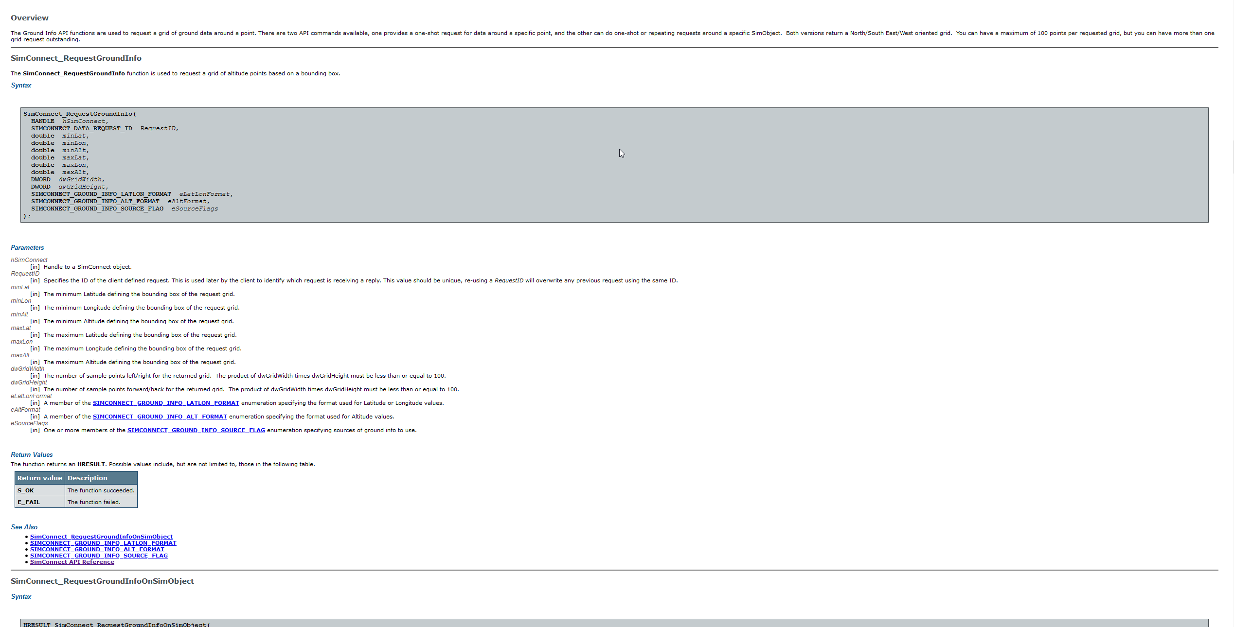
For terrain data (developer forum post is here):
"Having a native API present for both WASM and JS gauges which can return terrain elevation data at multiple distinct points over a defined area is necessary for creating a proper custom terrain radar, as well as vertical situation display, and enhanced GPWS.
There is a function in P3D which accomplishes this via SimConnect - however, given the lack of an efficient data bus between WASM and JS, also having this available natively in JS would be greatly appreciated:"