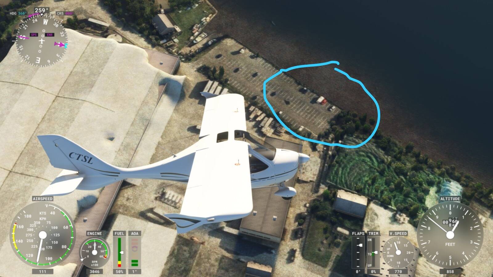
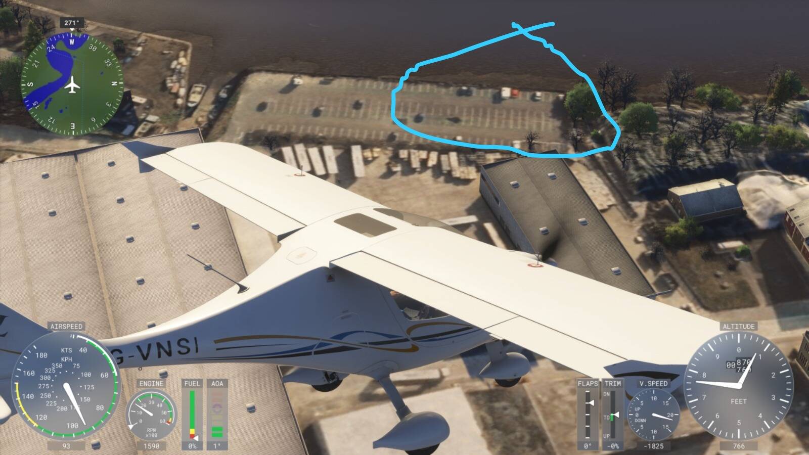
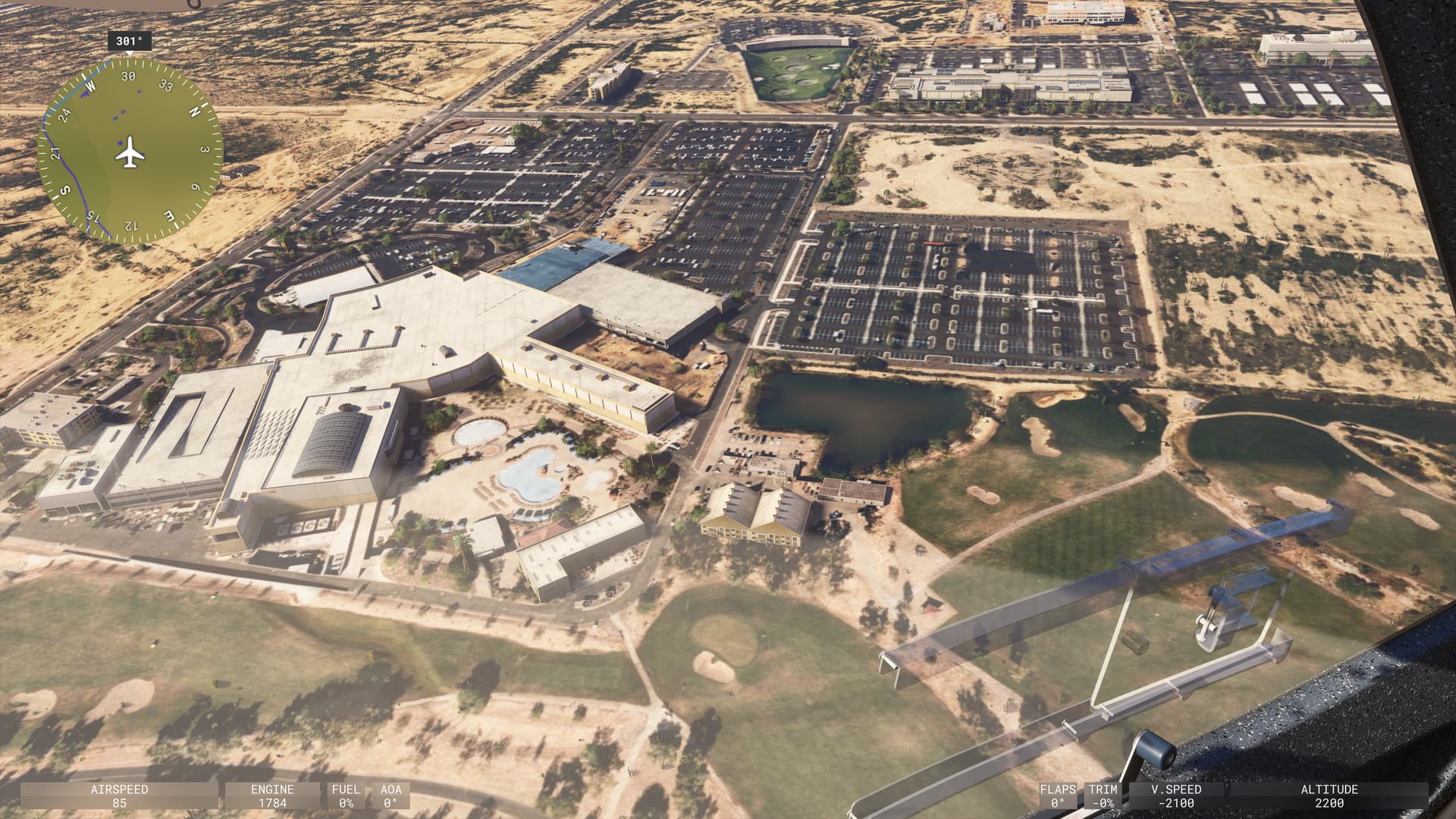
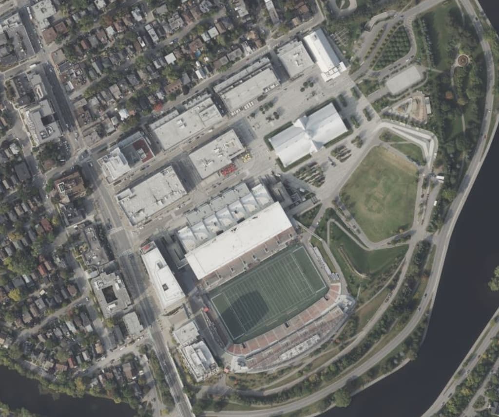
It would appear that the latest bing satellite imagery is now live in both sims? if so, this is great news and also confirmation that “things” are happening behind the curtains,
can anyone confirm around your area? Parking lots are ideal for this.
That is not correct. MSFS was always behind the current Bing maps aerial imagery. The building i could see on Bing maps was not apparent in MSFS. I think MSFS needs color correction for Bing maps, that must be why…
i think you are correct, msfs doesnt feed directly from bing
they take what they call a “snapshot”, essentially making a copy, and then stream it from their own msfs servers, most likely to apply some processing magic of their own, and they used to be way outdated, in my area they were from like 2013 or something…
now its up to date, i would very much like to know if it is global
correct. they remap the bing images to the MSFS coordinate system, postprocess, maybe fix some tiling, and have a “hard” copy on the MSFS servers. great to see that they have a refresh
@TOLOWTERRAIN723 What am I missing something that indicates a Bing update? While there appear to be fewer PG trees in 2024, the same cars and trailers seem to be parked in the exactly same places in all three screen shots.
Fair enough, and when I do turn PG off it reveals newer sat data underneath. However, whats the point of not playing with PG if I have the hardware to do it just for new data. It either looks like ■■■■ with generic buildings and slightly updated bing data, or half-decent PG with data longggg before the sim existed.
Anyway, you’re still wrong in thinking this is a global update and matching bing as you see it now, it definitely isn’t. The sat data around that area was still outdated somewhat, and looking at projects around my area the sat data still looks 2029-2020 era with PG off. With PG on, its easily 10+.
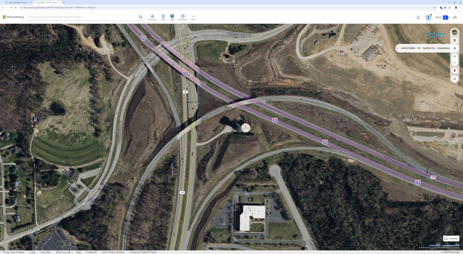
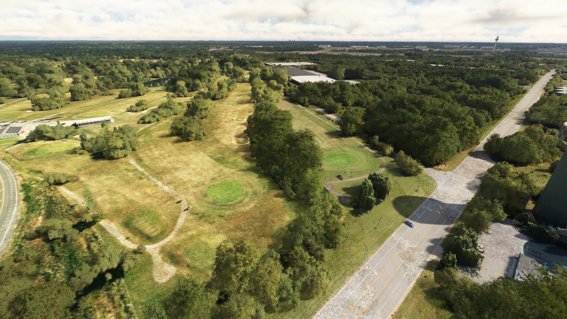
I could give a rats derriere about parking lots. Someone needs to fix the missing roads and bridges! Go to KGSO and drone out to the checkered water tower. The sim knows that there are supposed to be roads there - there are cars driving through the grass and even in the air and over the trees where one particular on-ramp to NC Hwy 68 is supposed to be. Those roads have been their for over a decade, and show up on Bing Maps, so why can’t they be represented in the sim correctly?