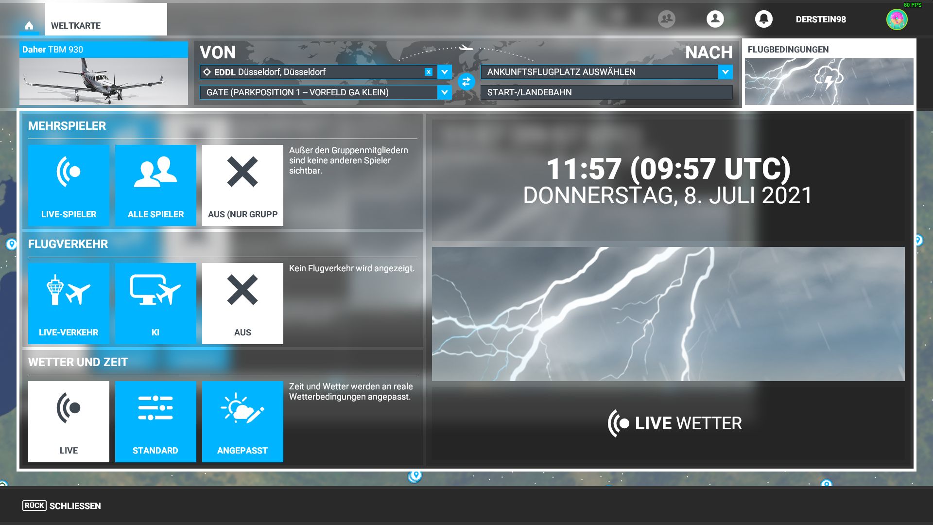
As I understand, Meteoblue’s model would do the weather generation in real time while taking into account the latest METAR data. Weather depiction with real time METARs is not something new.
I know it’s not, it’s been the standard in many flight sims for a long time now. But Meteoblue’s model is formulated and sent to MSFS ahead of time, it isn’t something which is constantly being streamed 24 hours a day in real time. So it’ll be interesting to see how they merge their model with metar data. I know they already do it for the winds temps and pressure, so it’ll be interesting to see how they further integrate clouds, precip etc
i don’t know how this real at all, after take off in the heavy rain in tokyo yesterday, i expected to go up under clouds maximum at 5000m, but no, look at this altitude, overcast was all the time i climbed around

Still boggles my mind that visibility parameters are still completely missing from the sim. Such a huge immersion breaker. The atmosphere is always cavok and crystal clear as if in space.
9 Likes
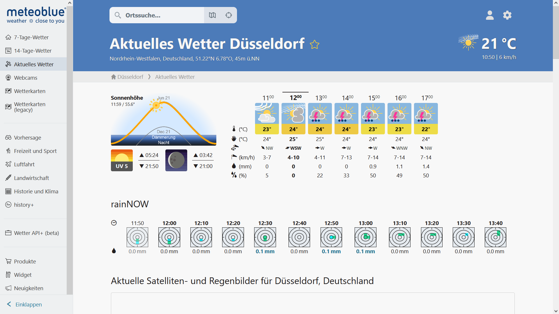
I’m flying in the Miami airspace now and live weather doesn’t make any sense with the real weather.

Same here. I was near Miami as well. Clear skies in the sim.
1 Like
I noticed the winds are stuck flashing at 270/02 @ FL340.
I’m currently flying to KORD and noticed this earlier.
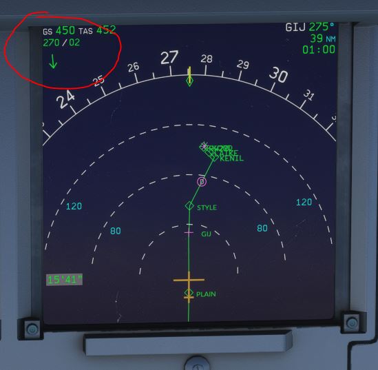
That is a sign that Live Weather is not connected to your sim at all. I did do several flights yesterday afternoon and evening, and had Live Weather with no problem. This may depend on which particular server you are connected to.
1 Like

The weather over Danmark was spot on tonight. Except for the abundance lightning. No proof given, just my word ![]()


I’ll stick to X-Plane 11 until such time (if at all) this particular omission gets a fix. As of now they are more focused towards kids with Xbox who would want to fly with all assists maxed out and land anywhere.
I did a kind of short comparison here:
https://forums.flightsimulator.com/t/ability-to-change-meteorological-visibility-rvr/248583/69?u=falcon07037670
4 Likes
Been flying more, and the weather is just so disappointing. You listen to the automated weather in sim and it doesn’t even match Live weather. You go fly and the weather is not even close to accurate, constant thunder and lightning from clouds that aren’t even large enough to rain.
For a game that looks so good, the bit that you fly in is so poorly done and appears they refuse to work on it as each week we get told “no plans to open up to Third Party” which translates to, no plans to allow for something that works.
This is not good enough.
2 Likes
They said in the last Q&A that they knew about it. That it would be improved by the end of the year and that there will be something mind blowing coming later next year. They literally said they would probably have the best weather system ever made.
1 Like
Basically the issue is that Meteoblue model itself doesn’t have a direct 1-1 relationship with the actual local METAR conditions. On the top of that, the sim as of date seems to have only the very basic elements to create weather. While the existing model has all these drawbacks, they are dead against opening the weather system to third party devs and instead have put the weather system overhaul in some long term indefinite pipeline which is a shame. Had it not been a locked system, we could have had much better payware systems from developers like REX and ActiveSky which have a long history and experience in developing such add-ons.
4 Likes
We don’t know what kind of contract Asobo has with Microsoft but if they were to keep contracting out there could come a point when M’soft start asking for what they are paying for? Asobo have their own weather engine, it may be not quite be the finished article but it is theirs so why would they give that up after so much work already?
Then what will become of the sim when the contract ends and the core functionality is still locked from being fixed or modded?
That’s something I believe Asobo must have factored in given that these licenses are not temporary ones.