I’ve observed today that airports I’ve loaded in at that should be overcast but are clear, seems to be down to Meteoblue having incorrect forecast/info. Take EGCC for example, overcast all day and still reporting, yet Meteoblue thinks it’s clear.
Just recently it seems Meteoblue’s forecast accuracy has really gotten poor
How is everyone finding the weather seeing as this very topic was one of those SU7 aimed to improve accuracy.
For me and I know many others SU7 has made the live weather a complete mess, it largely doesn’t match METAR or Meteoblue now. Totally incorrect mess mostly, with connective ash clouds almost everywhere.
For me now currently with SU7 live weather is the worse it has been both in regards to accuracy and general depiction.
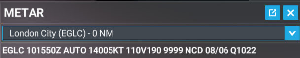
No cloud detected means the METAR can’t detect clouds, because it only detects clouds up to 5,000ft. It can be complete overcast as it has been over the UK today and still report NCD if that overcast is high enough to not be detected by METAR. We see that a lot here in the UK. Other airports sometimes even report CAVOK but can be totally overcast for the same reasons.
Nope, you are not correct. No cloud detected means exactly that, it didn’t detect clouds. It does not mean there are no clouds, just means it didn’t detect any clouds below 5,000ft.
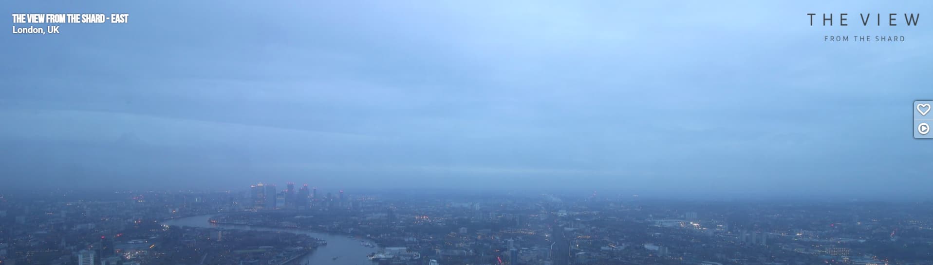
That makes sense. I’m digging out webcams in the area, and from what little of the sky that I can make out, as they are mainly pointed down at traffic, the sky does look grey.
I’m seeing quite a bit more pop-in and sudden cloud formations appearing, that weren’t present under the old weather system. I’m hoping this can be resolved.
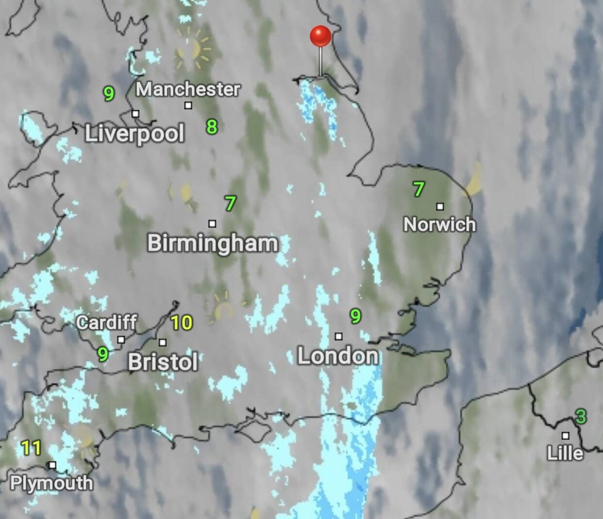
Yeah it’s like this across pretty much the whole of the UK, high overcast, this is why a lot of airports report that NCD or CAVOK because the cloud layer is just too high to be detected by the automatic detection used to generate these METARs.
NCD is used when an Automatic Observing System is being used and it means ‘No Clouds Detected’.
CAVOK means vis 10km+, no cloud of operational significance (base not below 5000ft or the highest MSA whichever is greater and no CB or TCU at any height) and no weather of significance to aviation.
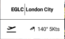
Yes it does as these automatic detection only detect cloud up to 5,000ft, therefore like you’re seeing at London city and like we’ve seen for example at Manchester today too, when the cloud base is higher than 5,000ft it can’t detect it and therefore generates a NCD in the METAR.
The fact you’re stating that there should be no cloud at all over London is simply not correct.
The other day, while on a group flight, I was flying through clouds when all of a sudden the particular cloud is was inside just disappeared. There were still clouds around me, and below etc. but that one just up, and vanished.
I’ve also seen the shifting, popping others have reported. I’ll be flying along when I see something jump in my peripheral vision. It’s like the cloud is still there, but has changed shape. I now feel a compelling need to re-watch the Matrix.
Observed this too, I posted about it in the BETA but not sure if you can still access that area of the forum but I observed clouds morph and change shape, almost as if it was switching between two weather depictions where one showed much more accurate defined shapes and it switched to a more generic one that was more of a mishmash of cumulus clouds.
No I’m not getting it confused at all, we very often have complete overcast here where I live by the airport and it will report NCD because that cloud is above 5,000ft.
I’ll again post the satellite of London here, which is reporting NCD. You can clearly see there is cloud there.
Yeah I think they have tried to smooth the transitions out a bit but said there’s still some work to go with the transitions so they are not so jarring.
So does that mean if a weather station is reporting cloud above 5000 they aren’t automated? Or do some weather stations have different/better equipment?