VHHX actually. VHHH is Hong Kong International, which is the newer airport that replaced Kai Tak and is separated from the mainland in the bay.
Thus VHHX operates just in fs2020. In a real world is inoperative or does not exist anymore?

Calling ![]() @Theduck38 and @Shack952514
@Theduck38 and @Shack952514 ![]()
I think that one has already been covered.
Thank you. Appreciate that.
Late to the party:
#16 Isla Culebrita, Puerto Rico - east of Isla De Culebra
#19 Prypjat River, Ukraine - southeast of Tschernobyl, where it joins the Dnjepr River
Good eye! @MrAngryBates
I’ll have to check these out in the sim later! Thanks for the additions! ![]()
Some hints for #18 #36 #38 #42. All those shots were in one of the Around The World Trailers:
#18 Tsaratanana Massif, Madagascar - probably Sambirano River soutwest of Maromokotro Mountain
#36 Marsabit National Park, Kenya - there is a very similar shot in the AtW-Trailer for Africa, Giraffes…
#38 Greenland, Denmark - hard to guess the exact location ![]()
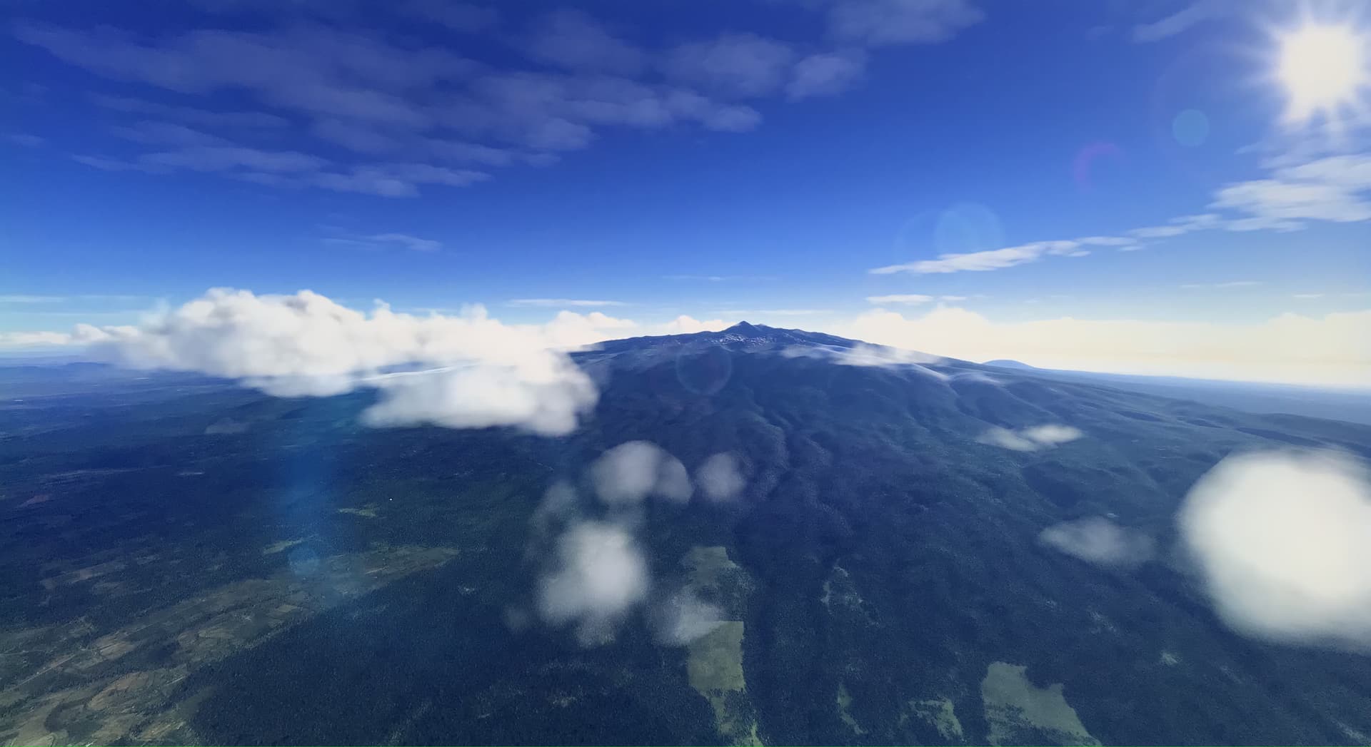
#42 Mount Kenya, Kenya - first shot of the AtW-Trailer for Africa
Probably you should dig through all the Trailers to find the rest. So many stunning and breathtaking locations. (Virtual) Earth is such a beautiful place!
Outstanding job @MrAngryBates!! I was looking for #18 quite a bit, mainly in Madagascar, but couldn‘t find it. You should consider participating in the „guess where?“ game.
@MrAngryBates
I’ve been double checking some of these and I’m not quite sure #18 is in that area of Madagascar. I’ve searched from Sambirano and down the Sambirano River all the way to the location Tsaratananamassief and Maromokotro Mountain. It’s all way too green and even the parts that are red don’t have the notable valley in the distance…
Yeah, it’s definitely hard to pin down exactly. The area is quite large and there are several river beds with lesser vegetation (Mahavavy and Manambato Rivers) further north that all look the same.
Also the peak of Mount Kenya doesn’t look like it’s RL counterpart. But this could be because of low DEM resolution.
But I’m 100% sure about #16 #19
Yeah you’re right. Some of them need some further searching.
#18 is a headache. I flew a trip around the region today. There are areas that perfectly match color, sparse vegetation and riverbed, but I couldn’t find the exact same location.
#36 is a bit odd, because there are no Giraffe POI in Kenya in the Sim, although the Trailer clearly states Marsabit, Kenya. Maybe it was pre-release and they removed them. There are 3 locations with Giraffes in Ethiopia, but the surroundings don’t match.
And I can confirm #42. It’s indeed Mount Kenya, the peak is partially hidden in the clouds in the Splash Screen. Here is a shot I did today:
I agree, this one’s been doing my head in for quite a while. I wonder why it’s that hard. I‘m starting to think that the place name given in the trailer is wrong or the imagery has been updated in that region. Strange.
Y’all… this one is a brain worm. I’ve also been searching for #18 for months. As well as number one on my list.
I thought #18 (Madagascar) was in the US around Monument valley / Mexican hat / Moab area. Wasn’t even paying attention to the preview trailers! I was only considering landing challenges, points of interest, and other notable in game areas.
Search continues ![]()
Just one out of probably some dozen locations in an area covering hundreds of square miles, that look like #18: Bing Maps - Directions, trip planning, traffic cameras & more
This is a needle in a haystack. I’m tempted to accept it’s somewhere in northern Madagascar. ![]()
Guys I believe I’ve found the location of the elusive screenshot #18!
We were thrown off by the “Tsaratanana Massif” thing. Apparently there are many places called Tsaratanana in Madagascar, and this one is a village way further south, with a dirt strip whose ICAO code is FMNT.
The screenshot location is a few miles to the north east of the airstrip, in the valley of the Menazomby River, at coordinates 16° 41’ 11,31" S 47° 42’ 46,58" E or -16.6863889S, 47.71277777777778E decimal.

Well look at that! ![]()
Well, that’s it. Fantastic! And it’s way more to the South than I was searching for.