I probably could but I’m retired from software engineering. It’s an exhausting job, but indeed well paid. The road network you see in the sim is the data I worked on in the past. Originally data from TeleAtlas, bought up by TomTom whom I worked for. I’ve actually written lots of “clean up” / validity check algorithms for the road data as well as the ‘faces’ defining rivers, lakes and built-up areas.
But updates are slow to trickle back, and a lot of our river data was never meant to be displayed the way FS2020 does. Abstract data for schematic maps used zoomed out on a gps device. Hence you see a lot of rivers that are just a blue line in many places. I would love an option to turn those off since the underlying sat data often looks better. Also rivers meander a lot, doesn’t matter for a GPS device shematic, but does mean they don’t match up with the underlying sat data. Road data was the priority, not keeping up with meandering rivers. River/lake data was more a do once and forget ![]()
Road data also comes with dates attached for planned developments. No idea whether FS2020 makes use of that data as I have seen many developments where the road mesh is already displayed while the texture data still shows undisturbed land.
It’s not easy, I fully understand that. Yet validity checks go a long way to fix those aquaduct rivers and weird holes. Rivers come with their own elevation data which doesn’t match the terrain elevation data. An algorithm shouldn’t have a lot of trouble finding these and move the river up/down to ground level. With Blackshark AI it should be possible to fix the misalignment as well with meandering rivers. It can detect trees, should be able to detect where the water is supposed to be.
Anyway I’ve never worked with photogrammetry. I have worked with algorithms to explore the entire road network world wide to find disconnected pieces, unreachable areas and other errors. In FS2020 I don’t even see something like that in play. Why are there so many ‘loose’ pieces floating in the air. And why does it take so long to clean up the underside of bridges. That’s easy to detect since bridges are clearly marked in the road data, crossing water data.
Well maybe not that easy since the road network only stores relative height, levels to determine what goes above what. However it doesn’t look too hard to determine to road deck height from PG data. Ugh I do want to work with it but I shouldn’t. I’ve already ruined my neck, right shoulder, elbow, wrist. So yeah, please keep working on it Asobo, but responsibly. I’ve still got plenty more than 10 years left in me, I can wait. But I’ll postpone my planned Canada tour for now.
Anyone want to see what Canada looked like in 2020 / 2021, look for the legs in Canada here
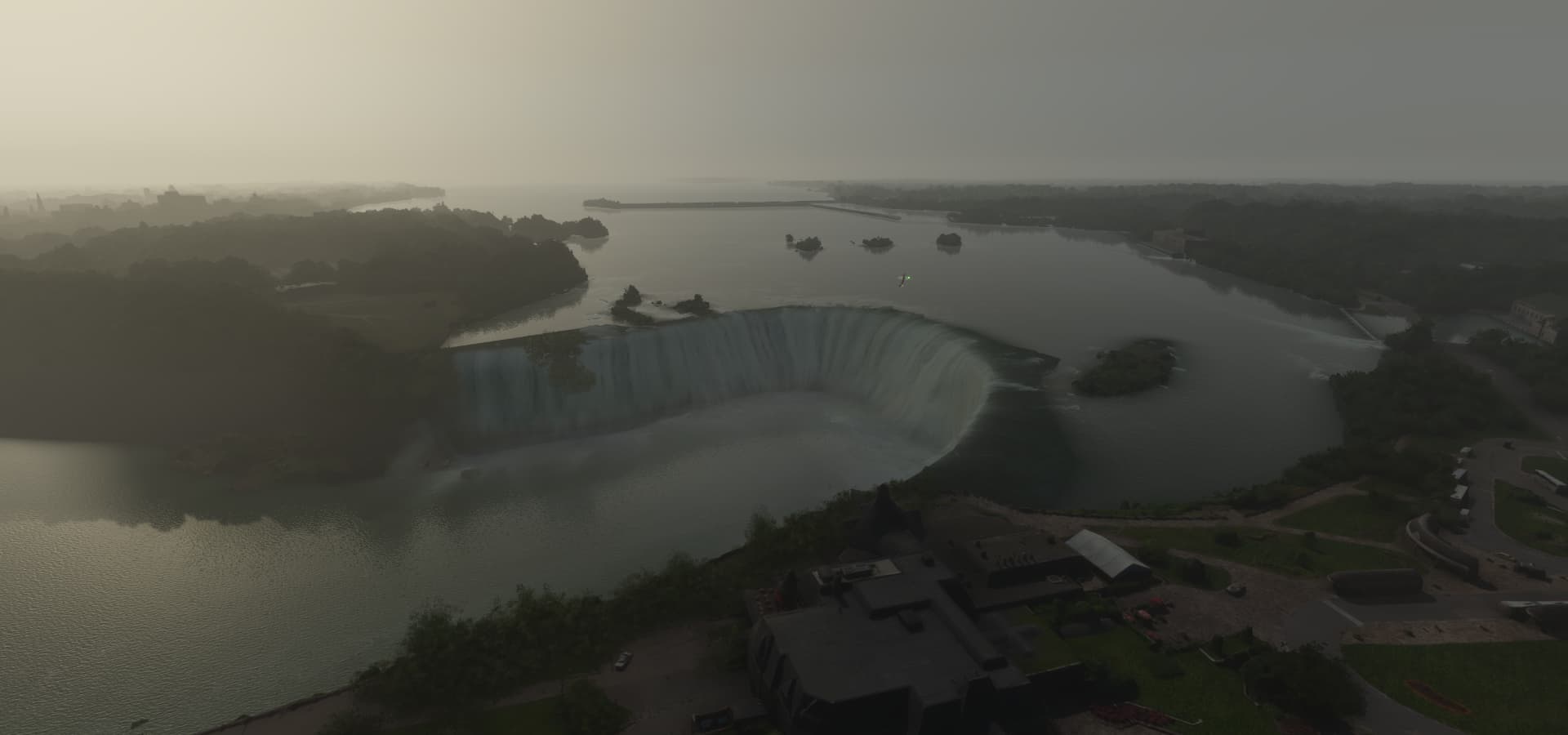
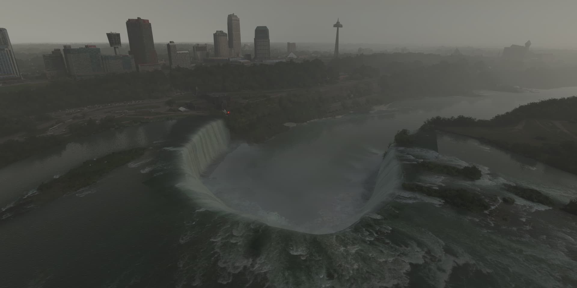
This is what Niagara falls looked like in 2021, weather wasn’t cooperating
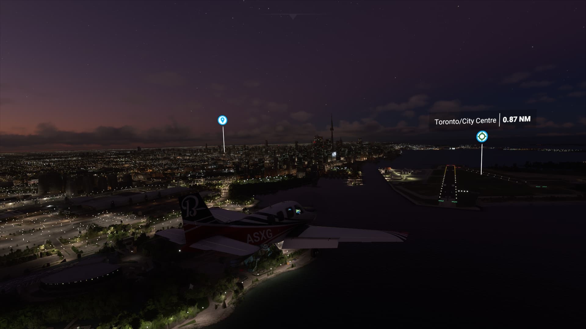
And Toronto in 2020, it was dark already when I got there
So was looking forward to make a Canada specific tour but will wait.
I was mostly hoping for better coverage up North, the national parks in particular, Labrador where Alone: Frozen was filmed. But it seems Bing maps hasn’t improved much if at all for Northern Canada. Alert CYLT and Grise Fiord CYGZ looked horrible with the scenery in between giant pixels. (Still no CYGZ in FS2020) And still trees in Alert ![]()