![]() Thank you using the Bug section, using templates provided will greatly help the team reproducing the issue and ease the process of fixing it.
Thank you using the Bug section, using templates provided will greatly help the team reproducing the issue and ease the process of fixing it.
Are you using Developer Mode or made changes in it?
No for testing, yes during reporting for position
Have you disabled/removed all your mods and addons?
yes
Brief description of the issue:
Significant problem that discourages a lot of people from using MSFS for gliding is too low spacing/distances between thermals and that those thermals typically cover too huge area - this makes realistic cross country soaring impossible and discourages glider pilots or people wanting to learn soaring from using MSFS for this purpose - for example classic MacCready “speed to fly” cross country strategy between clouds cannot be executed. People try to circumvent current shortcoming by setting wind speed to 0 thus completly disabling “ground thermals” and leaving only the “cloud” component - that says a lot about current incorrect state of thermals.
I am considering here the most common case of typical flatlands soaring with single Cu clouds layer - very commonly occuring case in Europe. Please also note I am concentrating only on “distances” aspect of thermals in this report, other incorrect aspects of current thermal model should/will be reported in other bug reports.
Expected changes in relation to distances between thermals:
- Distances between usable for gliders thermals should be the same magnitude as distances between Cu clouds visualized in given flight , as you should find stronger lift under every Cu cloud (unless it is an old, dissipating one), currently in MSFS strong, wide thermals can be spotted “densely” - almost everywhere, unrelated to Cu clouds.
- Near the ground airflow should converge more horizontally towards the thermal trigger, stealing warm air from larger area, thus reducing chances of another nearby thermal, currently in MSFS according to 3d thermal visualization it looks like air is being “produced out of nowhere” by the ground and rises parallely over huge areas without any convergence near the ground - not forming narrower column of air.
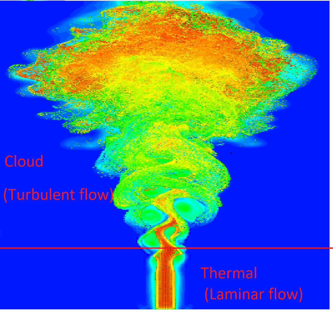
Current MSFS model doesn’t seem to account that thermal starts to rise at a specific relatively small thermal trigger and this fastest rising airflow leaves lower pressure area behind, that sucks air near the ground from all sides as depicted on this symbolic picture (taken from https://youtu.be/Sjt87U8qYBA?t=1487 ):
Please note the arrows of airflow near the ground pointing mostly horizontally towards the center of the starting thermal - this way thermal is “stealing” warming air from over large surrounding ground area - so typically there is single strong thermal (it may sometimes be joined by some weaker ones) and also because of this pressure gradient towards thermal core - thermals are not horizontally wide - typical gliders do wide circling of about 500m in diameter, and tight circling is around 200m (or even less).
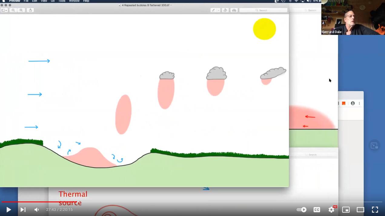
But I don’t want to digress too much into another topic of incorrect thermal shape and lift distribution - this should be another bug report.- In spaces between Cu clouds you should mostly meet calm air, some very gently descending air, some turbulence or if you’re lucky a thermal that is on it’s way towards condensation height where it should form Cu cloud in few minutes (the time it takes with given lift speed for this airmass to reach condensation height), if you are very unlucky you can meet downdraft, but it shouldn’t be that often and rather way less strong and wider then thermals (I am not talking here about vortexes caused near rising air bubble, that can be narrow and strong).
- With current weather settings it is not possible to create a preset with very spaced out Cu clouds - in real life, especially in the evening, Cu clouds tend to be well developed (over the best heat sources), but quite scattered - with distances between Cu clouds as high as 20km-30km - currently it is impossible to reproduce such scenario - in MSFS even with SCATTER parameter set to 100% we can do maximum spacing of less than 10km.
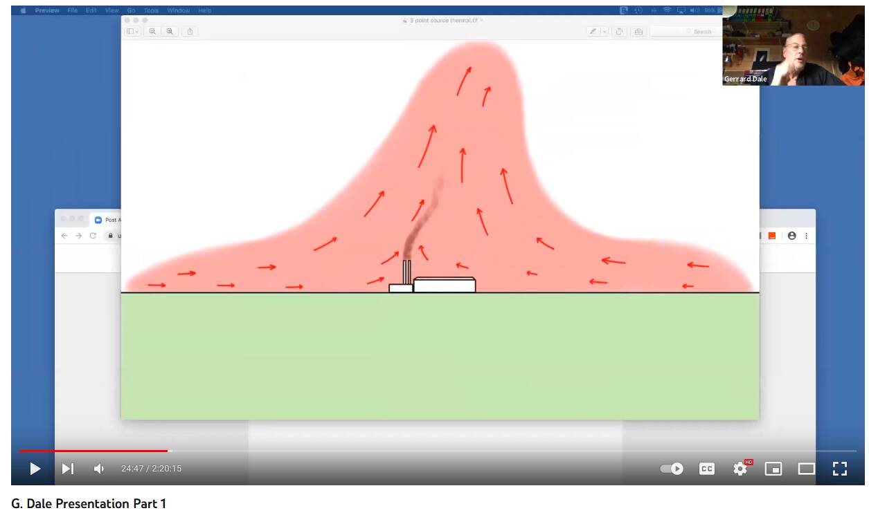
- There shouldn’t be 2 completly unrelated phenomena (“ground thermals” & “cloud thermals”) as currently seem it is modelled in MSFS - lift under the cloud should simply be the same ground thermal bubble that rised up to the condensation height and formed the cloud, clouds can generate some additional lift very near cloud bottom due to latent heat, but the largest lift component should be this air rising from ground - possibly drifted away from ground heat source with the wind - just like is depicted symbolically on picture below (from the same presentation):
Provide Screenshot(s)/video(s) of the issue encountered:
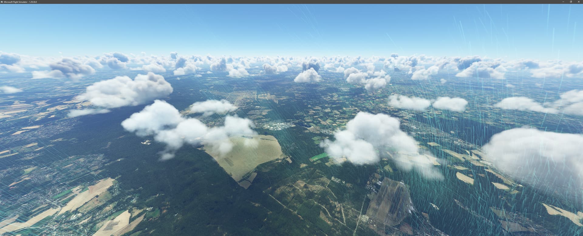
EDLO, time and weather as depicted on later picture:
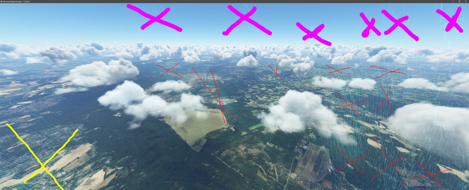
I crossed out places that according to my RL glider experience shouldn’t have significant thermal updraft as visualized by 3d thermal visualization:
Areas crossed out with pink color have totally unreasonable lift - top of clouds should denote maximum lift height, if there are such strong thermals they should form clouds starting from surrounding Cu cloud bottoms height (condensation height).
Areas crossed out with red are lift that is unreasonable in spaces between clouds - there shouldn’t be strong, usable for gliders lift between clouds (such lift would form cloud), please also note that incorrectly there is no 3d thermal lift visible under most of the clouds - or it misses their cloud bottoms (which is also incorrect).
Area crossed out with yellow is a huge updraft of air rising over urban area - while indeed urban areas are commonly generating lift this lift concentrates in relatively narrow column over thermal trigger - like a largest/hottest factory roof, most of other warm air is being sucked toward such thermal trigger thus contributing to this relatively narrow column of air, not “whole city” rising as visualized.
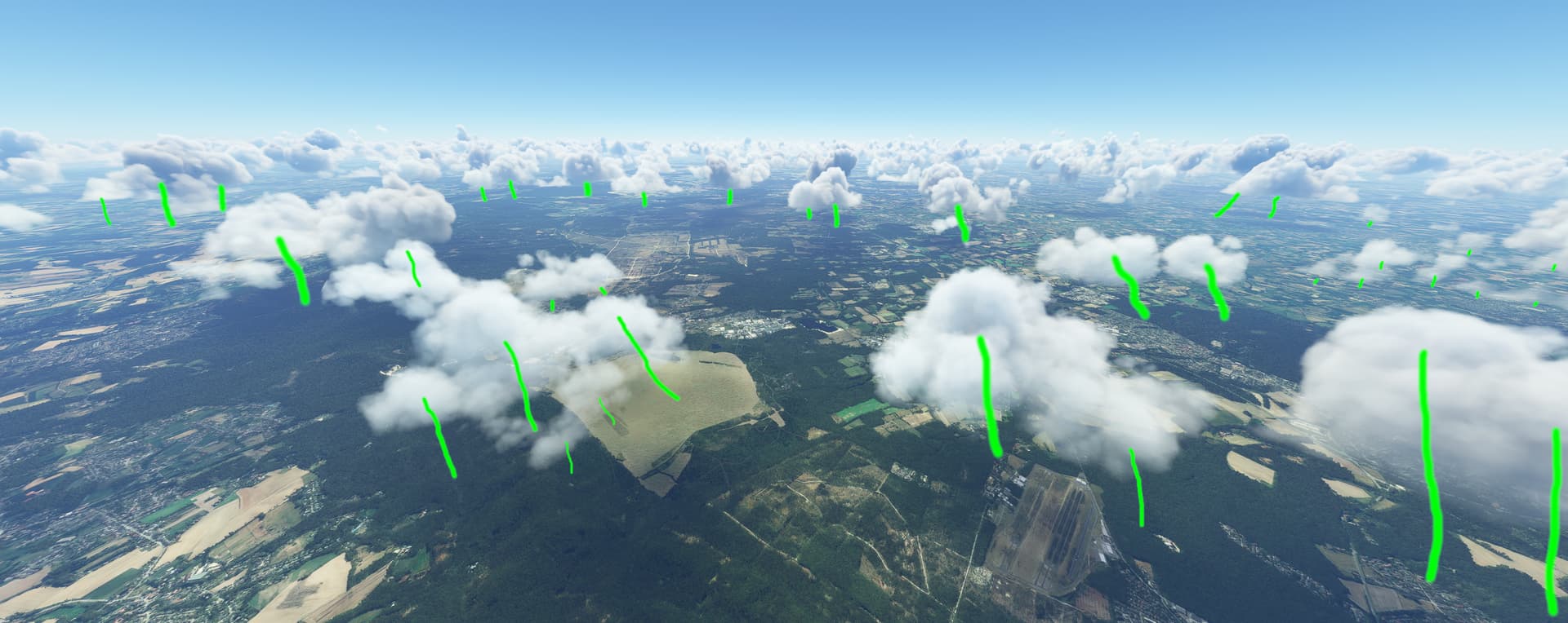
What I, as RL glider pilot would expect in this case would be:
Please note that I only symbolically mark with green lines places where I would expect cone-shaped thermal usable for gliders, in spaces between clouds I wouldn’t expect any lift strong and durable enough to be able to rise there circling with a glider.
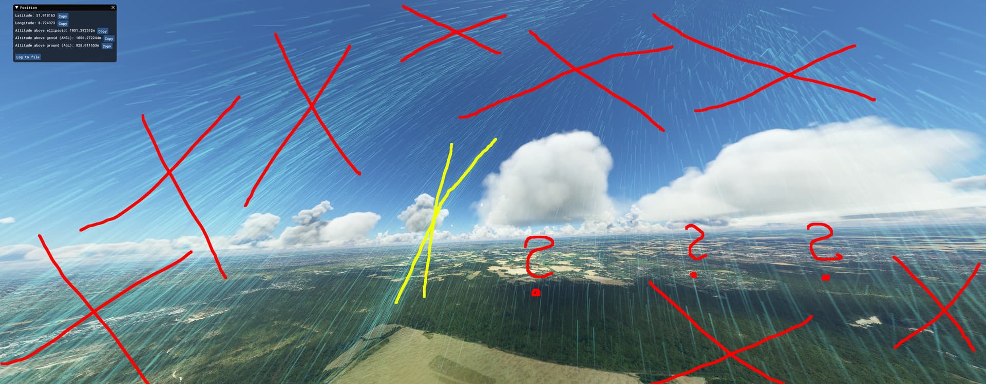
Another picture (same location) but from the side:
I crossed out huge strong lift on the left side of image that is “going nowhere”, that is doesn’t form any cloud at the condensation height.
In yellow I marked a smaller thermal that although near the cloud seems to be missing it’s bottom completly, please also note that in places marked with question marks 3d thermal visualization doesn’t show any significant lift.
Red crosses on the right side mark some incorrect lift that is too near to be the cause of those clouds.
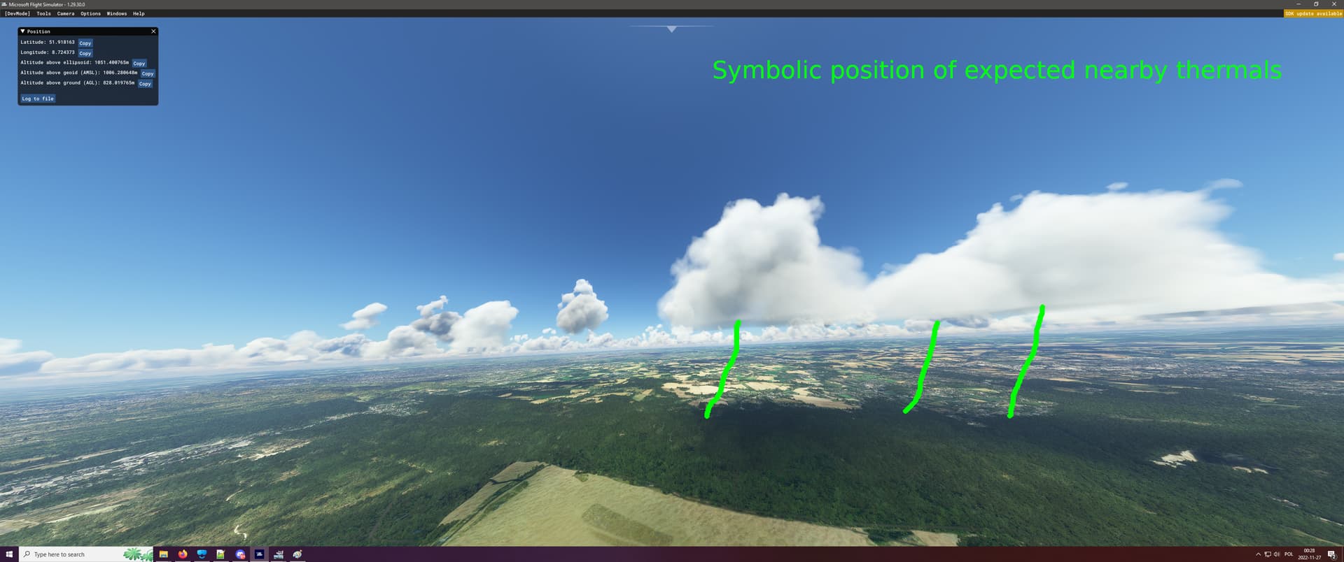
On picture above is a symbolical depiction what I would expect to see on the visualization in relation to the 3 nearest clouds (please note I only mark thermal locations I do not try to depict those thermal shape)
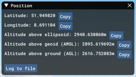
Provide coordinates (DevMode > Options > Display position)
Provide time & date of the observed Weather issue
EDLO - Oerlinghausen, 10 JULY 2022

Detailed steps to reproduce the issue encountered:
Use time & position as pictured above, turn on 3d thermals visualization
PC specs and/or peripheral set up if relevant:
does not apply
Build Version # when you first started experiencing this issue:
Can be visualized since Su11beta, experienced even earlier
![]() For anyone who wants to contribute on this issue, Click on the button below to use this template:
For anyone who wants to contribute on this issue, Click on the button below to use this template:
Do you have the same issue if you follow the OP’s steps to reproduce it?
Provide extra information to complete the original description of the issue:
If relevant, provide additional screenshots/video: