Flying with the ATR in Finland, this time Helsinki (EFHK) to EFJO (Joensuu)

12 Likes


Flew the PMDG 737 800 from Charlotte NC to Key West Florida
3 Likes


 - Quito Mariscal Sucre (SEQM) full flight L39 Albatros \"Drop Bear\"")
6 Likes
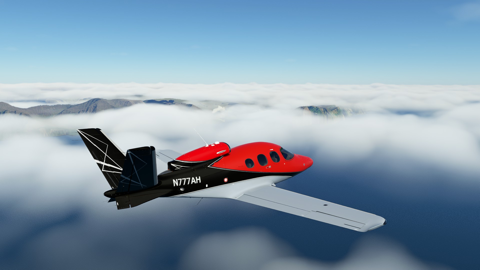
I flew over London in the new Vision Jet update, which is good.
But what on earth is this that’s invaded my xbox??!

It anyone knows of a bug thread for this please point me to it.
9 Likes

Took the Cessna 172 out for a spin through the Columbia Gorge from The Dalles (KDLS) to Cascade Locks (KCZK). Nice clear day but very windy! I brainfarted and landed the wrong direction (so with a tailwind, very dangerous on a short runway) but survived. ![]()
The sim replicates the rolling dry hills east of the Cascades nicely. ![]()

Oregon’s Mt Hood

Around the bend from our destination…

Landing (the wrong direction) at Cascade Locks. Should’ve entered right pattern for 24 instead, but brainfarted and entered left pattern for 6 with a tailwind, landed fast but ok. ![]()

13 Likes
Right in my back yard! ![]() Salmon Capital of the World!
Salmon Capital of the World!
2 Likes
Please tell me how you got an airworthiness certificate for that beast!
My wife’s family is from Campbell River. Spent lots of time at the airport and floatplane base with the kids plane-watching ![]()
![]()
3 Likes


I made some short flight from bilbao LEBB to LEVT Foronda, Vitoria, ir & vuelta


then made many hop in africa using the King Air


ending my day with the scrapyard community flight in Himalaya


6 Likes


Florida again, Palm Bay to Titusville.
Exploring a new aircraft: Robin DR400 with a minimal, analog cockpit. Superb view over the wings, and down to the sides. ![]() Love the exterior with the rivets and other details.
Love the exterior with the rivets and other details.
10 Likes
How’s the update, I haven’t tried it yet.
1 Like
Update awesome, everything works cool ![]() you have to try it
you have to try it ![]()
2 Likes
Today I joined my first community event (fast jets in the Mach Loop) with comms (Discord). I haven’t done multiplayer with comms in over 20 years since my old Falcon4 days. Thanks for taking me back! Cheers!
7 Likes
Did a little checkout on the v2 Vision Jet on tonight’s stream from Evanston, WY (KEVW) to Carlsbad, CA (KCRQ) I haven’t watched any training on it, so just went in cold and had a blast figuring things out as if someone told me to fly the thing or die. All in all it went pretty well. Amazing 3rd party add-on - definitely recommend!

Still climbing out over Salt Lake City

Utah Lake and Provo

Sunset splits Mt. San Jacinto and Mt. San Gorgonio on descent over the Coachella Valley and Palm Springs

On the ramp at Carlsbad
8 Likes