Why hasn't the quality of photogrammetry improved in the last 5 years?

That would assume the average PC has a lot of unused resources for FS2024 ands that is just not what most people see. If you set PC and Xbox next to each other (as we did this weekend at the FSWeekend) you see the same dataset provides a different experience. The PC version looked a lot better at almost any moment.

I have seen the comment you made many times, but everybody who puts them next to each other can see the platform will just scale down resolution and detail levels to match resources. It is often forgotten that doubling the resolution of something does not mean doubling the amount of data you need to process. A 2k texture has 4.2 million pixels, a 4k texture has 16.7 million pixels. Same with sight ranges. If your sim loads details in a 10 km range around the aircraft it needs to handle 314 km2 of data. Increase that to 20 km and you are looking at 1200 km2.

I do wonder…, and I am only on MSFS2020 how I could improve certain areas(Colorado :heart_eyes:) to improve for visual experience.
I took down to a friend of mine with big GB speed internet my two machines, an Xbox X which works stunningly good “apart” from MSFS2020, instantly in anyway awesome on my “HD” monitor. And my latest 6th Generation upgraded laptop, plugged in wired RJ45 as well.

I did not see much improvement in FS 2020 compared to my downspeed at home.
My friend of mine asked me, on what of a kind of a server ist that running?! That goes really slowly download on the other end…

Lately at least when I do load the official maps, and I compared them, are getting better, hopefully this will go forward, and FS is implemented. Hopefully…

I believe that to be true - to a degree.

My 3090 Ti struggles to not be a bottleneck @ 4K Ultra/High settings, and TAA is pretty much out of the question. I at least have the option to spend a whole lot of money (3-5 Xboxes worth) to get to where I become CPU-bottlenecked.

Even then, my 7950X3D, which is far more powerful than the CPU in an Xbox, only runs at 15-20% load, even with the improvement in multi-core utilization.

So I would argue that my PC has capabilities that the sim software is not yet optimized for, and certainly much more capability than an Xbox. Draw your own conclusions about why that capability isn’t being fully utilized.

Seriously with all gadgets I got purchased, like my Xbox X which fits just brilliant fine on “some” elaborated games, I do have the possibility to try for free the FS2024, but I do not want to run into that kind of a trouble waisting my time waiting at current so slow exaggerated download speeds. What can I twink on an Xbox X: nothing!
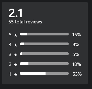
Look at what say few others till today in my current area about MSFS2024 Microsoft Store:


Who can believe such huge failure!

I am not up to research grade on PC to optimize that I could eventually have a good PG view of good known Colorado River by my eyes.

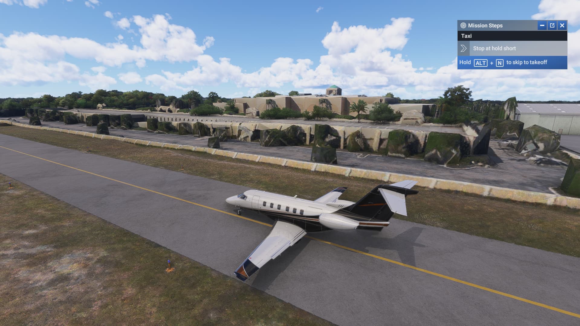
My recent photogrammetry experience at KBCT… trees are blobs, the building is close but a bit wonky


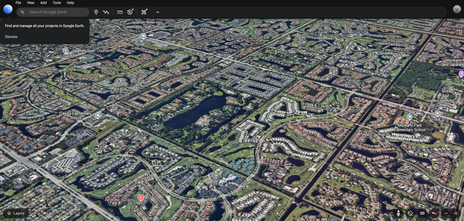
Also a comparison of the map data compared to Google Earth


Google Earth from about the same position and direction

The only thing to do with trees would be identify those objects procedurally, remove them from the TIN mesh, and replace them with autogen trees. Easy to say, but far harder to implement I would assume.

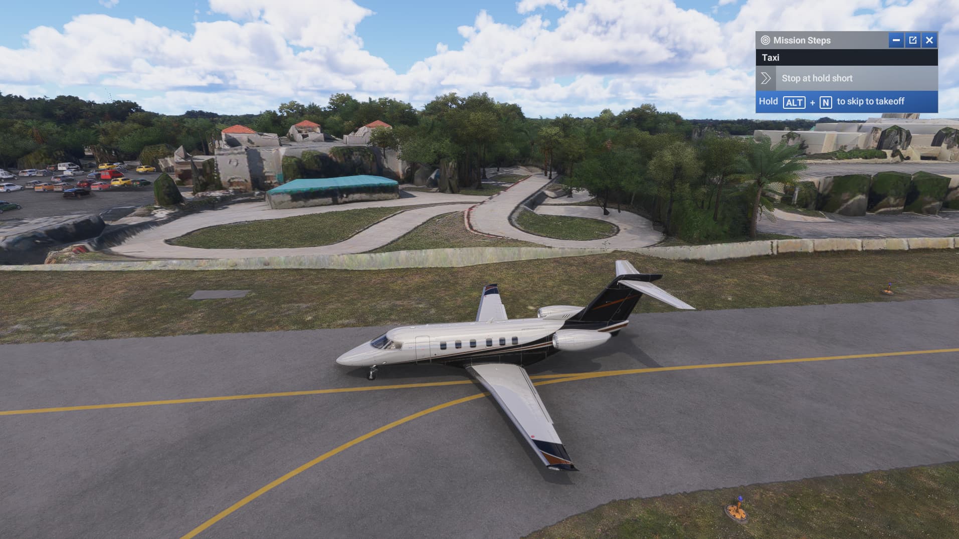
Yea I had a feeling it would be a “by hand” procedure. I don’t mind generally unless I’m landing a heli somewhere and just staring at blobs. just saw this thread and found that during taxi out for a flight

I’m curious with all the comments of melted scenery, if the experiences are for areas the user has not flown in before. I know I have seen melted scenery in large cities. Madrid was horrible when I first got there but I flew back and forth over the worst areas for quite some time and every so slowly details popped in until the experience was to my expectations. I have taken other flights there recently and I must have a bunch of it cached because loading times are much quicker. I think it’s just the limitations of streaming and the sim usage at the time you enter some new area. Someone mentioned London. It is visually stunning - along the Thames - but get a ways away from that and you’ll have some loading issues for details. The closer to the modeled areas you are the quicker things load but get a few miles away and you better hang around awhile to get the full detail.

Now scenery areas without built up cities like the Grand Canyon or most of Iceland are immediately richly detailed in my experience.

Think of how many high res polygons have to be streamed and rendered in a major city. The progress we’ve seen in just the last 10 years in this area is mind blowing. We get very spoiled by many of the games out there that have a limited world we can explore and our views are instantly crisp and clear but go out to the Google Earth app on Meta with a Quest 3 and pick out some big city to wander around above. You are going to have melted scenery and Google maps are better than what we’re using.

Planes have to fly over those cities multiple times go get a perfect rendering of the landscapes below and eliminate shadowing and all of it costs time and lots of money. Just imagine the amount of work it takes to just get the outside textures of buildings right.

I wish 2020 was as perfect as people made it out to be but there were lots of flaws in public areas where we didn’t have to pay or download extra to get more detail.

I get the outrage of some of Asobo’s and MS’s false hype with the preview videos. Those were carefully selected scenes that were heavily modeled and taken under perfect conditions none of us will ever experience but at the same time we should have known that nirvana was never going to happen unless we all bought massively expensive rigs and then the latency caused by the speed of light was always going to be there.

You could probably do it automatically if your rules for identifying them were robust enough.

Imagine the surface is like a thin, flexible cloth. The cloth has been dropped over something like a chess board, and all the little pieces underneath are leaving bumps in the cloth. Some of the bumps you want to leave alone, as they might be a building or other structure. But the trees you want to snip out. The ones that get snipped leave a hole in the terrain, with no textures so that needs to be filled with some graphic that doesn’t look out of place, and then you plonk a 3D tree down over that spot….thousands, and thousands of times.

I expect for what I can see on screen and compare with other sources that these Bing maps are catching up very fast this week?!

I used to be as in your statement, “till” yesterday in my area.

Changes are coming, I guess depends where you are.

Barajas, in the old days how I know things in real life(till today by side), with nearly all addons does have severe rendering problems. Might be to the WU(?), I did not have the sight in nor the time.
But I did noticed that any addon, will work in the end in “purple outdated” obviously wrong with especially demanding aircraft, no matter in which corresponding folder.
May I add humble that I ve been in real live often there.
May I apologize to your understanding that i look down 15degrees, to right side slightly 30degrees as I know how to in the Iberian Peninsula due to MSFS performance general.

In one of the dev streams this was talked about. Free standing tees are relatively easy. The problem is that a lot of trees and bushes collide with objects you want to keep. That makes it really difficult to automate the removal in cities.

I think the world hub could be a good place for us users to remove trees. You can create simple shapes to mask out the PG tree, automatically fill in the hole in the texture and then place a tree manually.

MS have a love/hate relationship with the World Hub. On the one hand they sell it as a enabler of community content, crowdsourcing the effort to improve default level airports. On the other hand…all of that stuff also. The concern from third party commercial developers was that it would take money out of their pockets, so what you could do in the World Hub was severely curtailed so as not to upset the apple cart.

I think that was the wrong approach. What they didn’t want was competition, so what you end up with is protectionism. There are an army of people out there willing, and able to improve the multitude of AI generated airports out there, the community could do very little, effectively down to labelling taxiways correctly, just to protect the likes of <redacted>, and <redacted>, so they can peddle their half baked efforts on the MP at a price.

Believe me folks, we got railroaded with the World Hub. What they should have said to them was “Be better! You want to charge $15 for an airport that someone is willing to make for free, then make it as accurate as possible. Go the extra mile!”

If you want a good example of how it should be done, look no further than the X-Plane Scenery Gateway.

https://gateway.x-plane.com/

No restrictions other than the assets be available in the default sim, or you can create custom buildings, using their custom tool, WED. These updates get pushed out with future updates of XP, and the submissions are vetted by peers as well as, I assume, Laminar.

That’s what we could have had, but once again the money got in the way.

MS policies are getting in the way of real progress. It could have been something beautiful. <sheds tear>

Bing mapping is ideed poor comparing to 2020. There are also anomalies with buildings placed wrongly, eg the humongous tower block in Weston Super Mare UK which has been not addressed so far despite the several reports from diffrent users. This happens only in MSFS 2024 so cannot figure where from the data is being pulled.

That building and other similar examples are nothing to do with Bing or photogrammetry.

Unless I’m mistaken the data on height for algorithmically generated buildings is from OpenStreetMap. The discrepancy between 2020 and 24 could be down to someone incorrectly editing OSM between the releases.

As for trees especially, you may want to consider Bijan Seasons Enhanced Trees mentioned in another forum topic. He has worked on many areas of the world - example, the Southern California coast - to fix the quality, types, and size of trees. He actually responds to users requests and fixes areas within a period of days/weeks. For Santa Barbara, I asked him to only use Autogen buildings right at the coastline to improve the palm trees there but leave the recognizable (but melted) buildings at the center of town. Available on SimMarket

Photogrammetry does get updated - but from what I have come to understand, only in those areas (mainly urban) commercially interesting for investing stakeholders - MSFS is more or less basically piggy backing off of these projects - done for other reasons than populating data for the Sim.

You can sort of get an idea in this thread:

This explains why the status of the photogrammetry is highly dependant of the location.

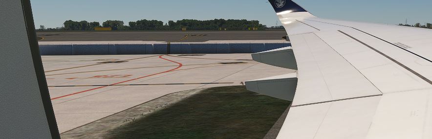
I want to make a flight tonight, but impossible to go to the runway from gate because the “photogrametry” (wich is in this sim are the most retared one i ever seen it’s simply inadimissible to have it on msfs) are not flowing ground path with aditional scenry for lfpg so in result i have what is on the screenshot.
THANKS FOR MAKING ME LOSING MY TIME, IT IS INADMISSIBLE WITH A SIM WITH THIS PRICE!!!


(for information, it was working fine all the day and yesterday as well

Most cities are either half decent or outright Zombie Apocalypse.

Game is very inconsistent and the countryside usually breaks immersion as soon as youre low enough to see a small village etc.

Not great.