I think more than 100 a day. My last one was number 68,000 and something - so that’s more like 1,500 a day
I don’t think it’s universal. There’s significant portion of users that are affected. I’ve definitely seen proof of it being broken and proof that it’s not broken.
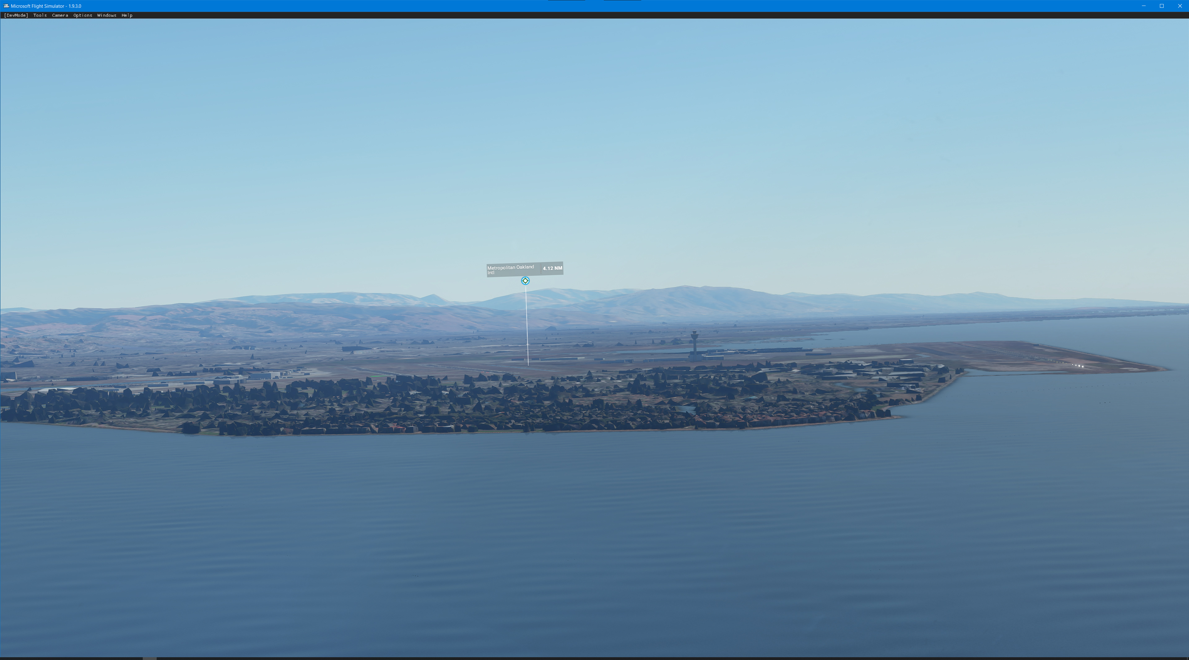
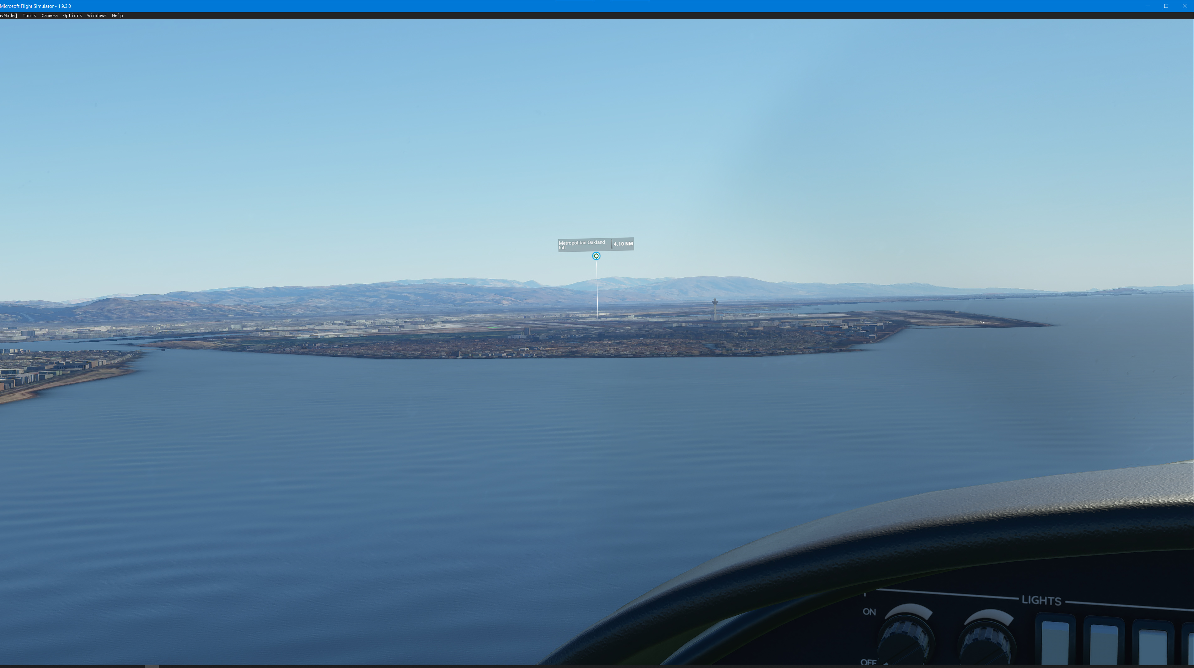
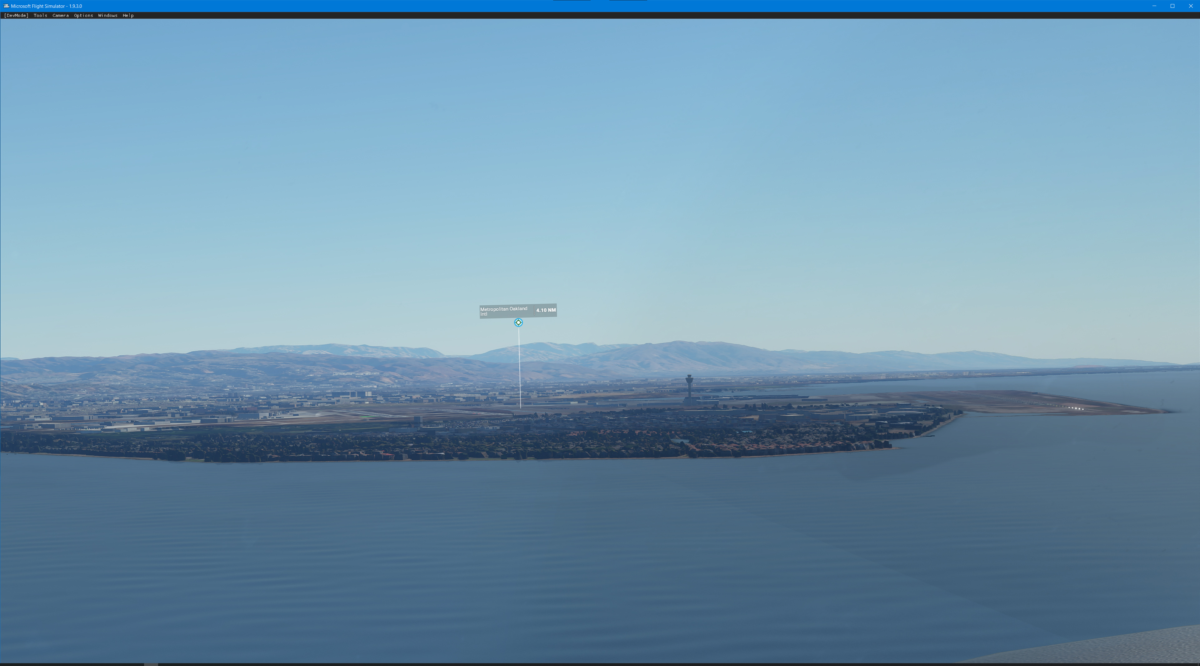
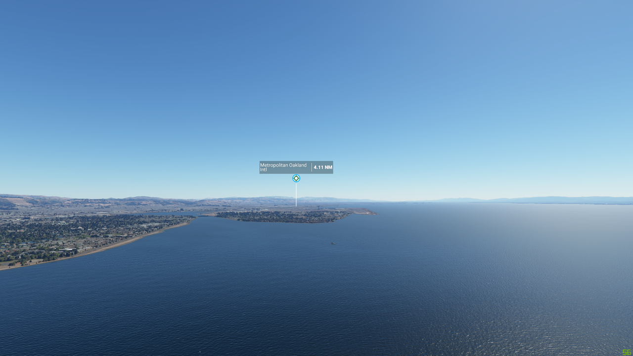
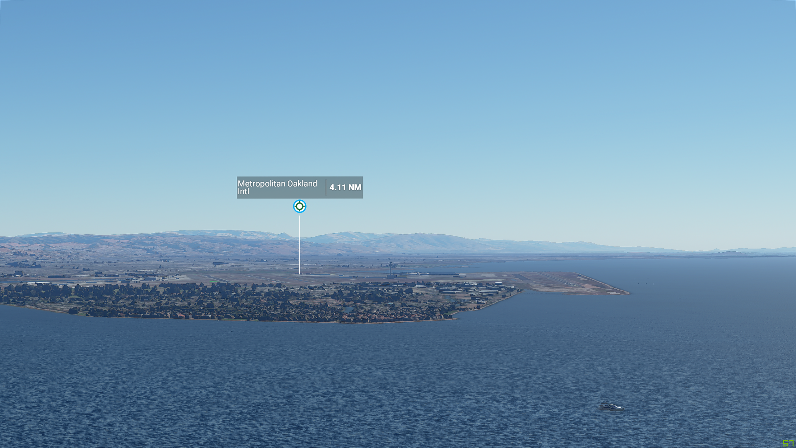
My picture is going toward Oakland Intl (KOAK). This specific flight was to fly out of Oakland and went around SF skyscrapers then I turned around and approached KOAK from the north heading south. If you need more specifics, I can try to put a flight plan together later.
I believe LAT, LON, ALT and HDG are enough.
I’ve tried reproducing the screenshot from @Kjdsider2 with various settings:
ULTRA 200% Terrain LOD:
ULTRA 1000% Terrain LOD (via cfg file read-only):

ULTRA 1000% Terrain LOD Autogen (no-photogrammetry):

Using My 4K Settings Terrain LOD 150% Autogen (no-photogrammetry):
- I shall mention during these tests any 1000% LOD setting was giving really bad fps and was not flyable.
- I personally find auto-gen better at this distance and at 150% LOD compared to ULTRA 200% photogrammetry.
I’m wondering whether Asobo could use autogen for outermost rings and photogrammetry for closer rings but with more mesh details in order to avoid the pyramidal low-poly count pseudo-buildings, and what this would give in terms of visuals, something which I’ve quickly mixed like this:
Whoa. Thanks for trying that out. Seems like at this distance of ~2nm the houses are still molds, even at 10.0 LOD. When you get closer to land, the houses will start going through progressions to look more like houses and less like molds. Do you think that action can be triggered earlier? If not, should we ask to see if asobo can do it?
I would bet that the houses popped in a lot sooner on the launch version.
If you would like to see an example just scroll up. CptLucky8 just posted a pic and you can see the trees and buildings looks like cube. I see this in a lot of cities. I’m running ultra everything and 200 for LOD and it still sucks like this.
At launch, I couldn’t even run Ultra without being stutter filled and low FPS in the teens. Now I run ultra at 35 FPS… I would like to be able to control if I want to sacrifice some FPS or not. I’m ok with 20-30.
What’s missing now is that I don’t get stutters when looking left and right while inside the cockpit. I can only assume that the game decided it was time to render the side I started looking at to a respectable quality. I don’t feel like it’s reaching the same level of quality now, and as they said, it was probably an accident.
37° 45’ 34.51" N 122° 17’ 35.70" W. You can also load up the ILS approach into runway 12 at KOAK. Head towards the KOAK airport airport. 106 degree M. I did about 750-1000 feet or so.
Thanks will try this tonight
Whenever you feel like it. TIA
The difference is more than just being “slight”.
While you may not be able to see it in the pics, the difference is certainly more than just a slight one and it has changed the experience quite a bit. In the early alpha, the extended views were amazing and the performance was stellar.
Once you have seen it, it’s so dissatisfying to not see it anymore. The whole make it smooth for everyone approach is lame. That’s why there are sliders in the settings.
Personally, I think it could have been a money decision to save streaming bandwidth. However, I do have hope they will bring it back to some extent since they mentioned in the last Q&A.
This issue is worth repeating until it gets fixed.
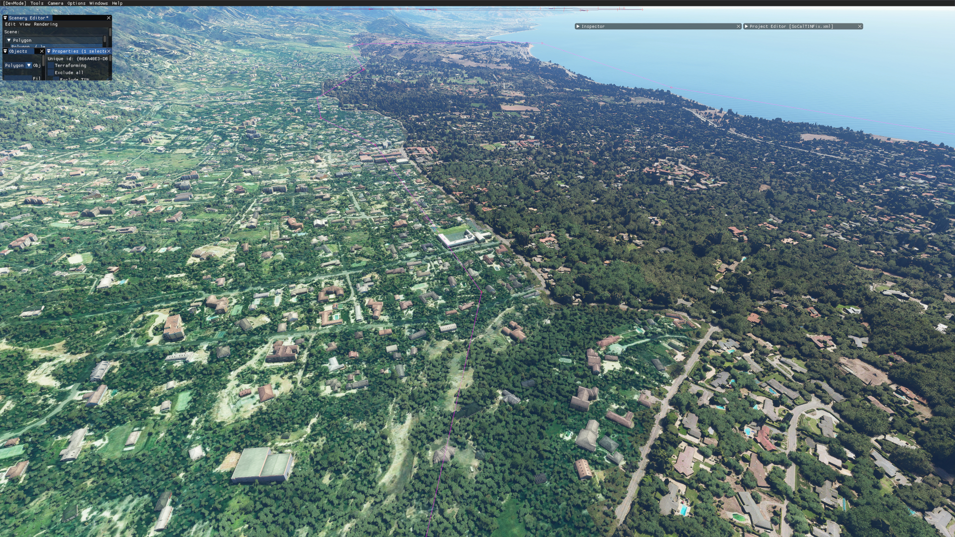
OK, so I think this is a problem with the TIN throughout specific areas of the country. Look at the Santa Barbara, California area in particular and you can see a very specific border with different texture running along the highway where it seems like someone specifically went in and delineated where photogrammetry would be used versus leaving it up to autogen.
The reason I believe it is the TIN is because in the KSBA area, I made a huge polygon and told it to remove TIN and force buildings and it completely took away the mud and then autogenerated buildings and the area look simply beautiful now. Is it completely accurate to real life, not necessarily, but it does show that the issue is the height data provided with the TIN and the interpretation of that data.
What I’m seeing is there is one single high point that the TIN is provided, which is why all of these brown mounds are cones. Just about everything is built this way in these specific areas. I think what we’re seeing is something being messed up between the game showing these brown-mound TIN interpretations and the game removing that and placing the actual building that is supposed to be there.
For now, I’ve placed huge scenery polygons around these areas in Southern California and I’m back to simply loving the scenery. Is it real to life… no, but is it better than massive brown mounds jutting out everywhere… you betcha.
In the below images, you can very clearly see where the autogen stops and where their delineated area of photogrammetry starts. It’s terrible.
You can see here, the brown mounds all over the place. This is the TIN.
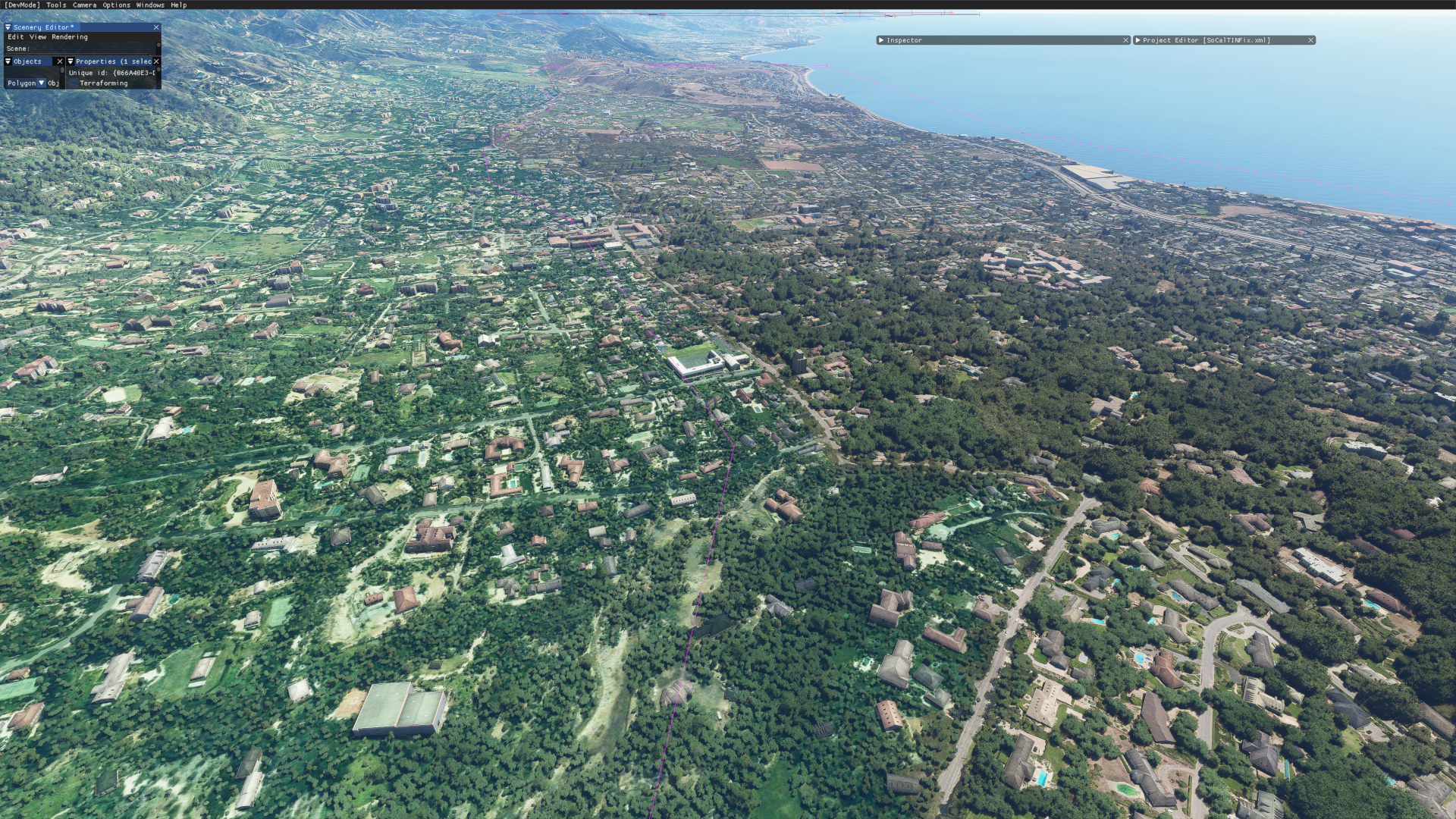
Here, I have gone through and removed the TIN and forced buildings.
1 Like
This issue isn’t universal though and is dependent on which areas. It’s definitely one of the things that could be better.
Here’s my version. I realised that you have zoomed this in a bit, so here’s the no zoom/zoomed version
No zoom
Zoom
Which I think looks essentially the same as yours. What I also noticed is the pop in as you get closer. I’ve not seen that nearly as obviously in other PG areas, so i wonder if this PG area is a bit glitchy (when flying over, I can see flickering parts to it too). Also I think the low angle to the PG v the height of the autogen it repalaces maybe emphasises the pop in. Definitely wierd.
Do you see this in other areas too?
1 Like
I don’t fly too much so I can’t say where else. I see it heading to San Francisco. In San Diego I can see it happening on the skyscrapers as I move closer. Buildings/areas seem to go through multiple redraw improvements like how a slow connection with a browser would improve jpegs back in the day.
Weird thing is my first flight on week 1, to San Francisco, it was not this jarring of an effect. I did zoom in too then. Maybe it is related to the area AND the changes they made.
I found a work-around for the temporarily broken anti-aliasing that doesn’t involve any config file editing or mods:
Set Global Render Scaling (I think the term is) to anything above 100. I raised it from 100 to 110 on my RTX2070, and it made a world of difference with no noticeable performance drop. I should say that my monitor is 1920x1200, though. It may not be a feasible solution for those with higher resolutions or slower graphics cards.
1 Like
There are discussions in the forum about how this setting reverts to 100% every time you launch the simulator. This means if you’re used to setting this one say at 110% for better looking graphics, the next time you launch you’ll find poorer AA even if the GUI slider is showing 110%. It seems you have to change it again for the setting to apply (1.9.3 bug)
Okay, I’ll check that next time I fly. Thanks.
Following up on LOD questions, I’ve just created a new discussion with a stunning discovery about Trees and rendering distance: LOD problems - Trees Fix Revisited
Following up on LOD questions, I’ve just created a new discussion with another stunning discovery about LOD ring distance: LOD Problems - Distances revisited