I am having the same problem in the area that I normally fly SEQM-SERB, until yesterday the photogrammetry was correct. Only the highest mountains were covered as is in reality with snow, but after the update many elevations have that low textured snow cover.
Regarding the ENSB LOD issue, I can confirm it. I just landed there and the only area that loaded somewhat higher resolution textures at the last minute was the immediate vicinity of the airport.
I think it’s possible that this issue is somehow related to this other issue (which I also experienced):
As you get very far north, some parts of MSFS seem to stop understanding where you are. Since the loading of higher resolution ground textures is probably triggered by your A/C position, it’s probable that it simply doesn’t happen if the sim is not interpreting your position correctly.
Any thoughts on this?
As for the snow in the ecuadorian valleys - that’s a pity. I grew up there and I would be really sad if something like this kills the immersion of flying there. Nevertheless, I believe that to be a separate issue from what happens at ENSB.
As I said on a (now deleted) previous post, this issue has always existed in northern areas. I used to see it a lot in Alaska several months ago, closer to launch. The new aerial imagery at Svalbard probably brought it out in this case.
What WernerAir said above could be true. There are several other LOD issues when approaching the poles, the reduced tree draw distance for example.
What is rather strange to me is the fact that they choose to make a custom airport at Svalbard and before its release nobody notices that you can’t actually go there from anywhere else. I have the impression that IFR flying is not part of any pre-release testing.
After loading in the gps and vfr map were showing the wrong location, in the middle of the ocean. After moving the map for a bit it started to show the correct location.
Interesting. I couldn’t get the VFR map to show my actual location no matter what. I just can’t pull it further down. This is what it looks like (notice the little bit of land at the top, which is acutally the southern tip of Spitzbergen):
I think i took off from Svalbard, landed, moved the map around a bit in the Garmin GPS and then the plane icon snapped to the right location. Very strange i will have to try it again.
This comparison by ObsidianAnt shows off what happened with this World Update (watch until 2:34).
Previously only the low-resolution imagery existed, but now the new one does not draw out very far. I imagine that this could be because they haven’t compiled the new imagery at lower LOD levels, or it’s just bugged in areas closer to the poles. Something similar might have happened with Alaska in the USA World Update.
As to why they chose to make a custom airport at Svalbard with this glaring issue, perhaps only the high-resolution imagery was loaded into the scenery editor/developer build, and when testing it in the simulator, there wasn’t much point to just cancelling all the work they’ve done.
I guess they’re aware of it, but they did say when it comes to cosmetic/visual issues they rely on the amount of reports in order to prioritise them, so I would urge everyone to send a Zendesk report.
Its better data then we think. There is something wrong with the LOD. So you have to go very close to an mountain or object for them to load a high quality LOD. I think its linked to a latitude bug that is fixed by Asobo in the upcoming sim update.
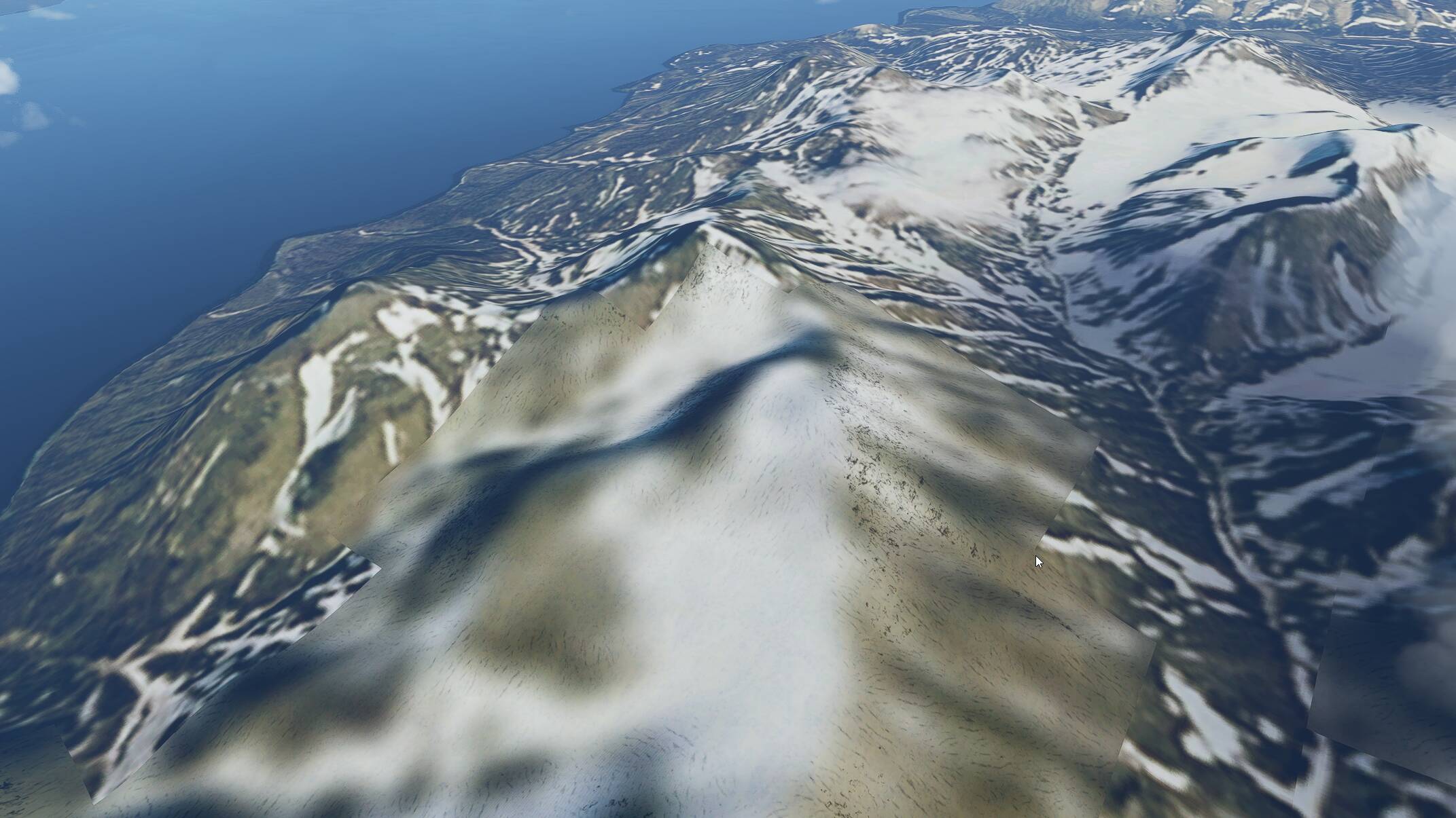
I think this problem is affecting other areas all over the world. Today, I was flying over Mount Kenya, and there are some points with low res texture that doesn’t load, as well some “white bug areas”. I really hope that they fix this with next update!
I agree that the problem is not only linked to latitude. I just made a flight in Colombia and had the same issues: In some areas, the resolution seems to get lower when you approach, especially at high altitude, and when you’re directly above it looks really bad. By the way, there are a lot of places in northern Colombia where there seem to be clouds in the satellite and/or aerial images (looking a lot like the screenshots from walterdog9598 above), and a little bit it looked like the lower resolution appears especially in these places - perhaps as some sort of algorithm to disguise this. Now I am still convinced that this behaviour was introduced with WU5, as I have flown in the same area before and I never observed it before. I really hope it gets fixed in the next update.