Hello all. Like many of us, I was a bit confused upon MSFS’s release on why the weather I was flying through in-game was so different from the usual METAR sources I used during my FSX and (gasp!) X-Plane days. Live weather means REAL weather, right? Wrong. I’ve now learned that my expectations don’t necessarily have to be tempered, but recalibrated. Hopefully this post is illuminating to some, and if I’m wrong, I hope to learn more, too.
First, a disclaimer. I understand there was the wind problem, Live weather simply not loading properly or at all, the visibility problem, “LIVE WEATHER UNUSABLE ON VATSIM”, etc… Those issues have been rehashed so many times already and this thread is not about them. This also does not concern METARs, TAFs, winds aloft forecasts… This is how to use the Meteoblue site as a tool to get an OVERALL IDEA of what will be shown in the sim, and what you can expect.
Words and stuff
To begin, I think most are finally realizing “live” doesn’t mean “real.” At this point, everyone should understand that MSFS ingests MODEL data from Meteoblue and that’s what we see in-sim. It might be spot on, it might be completely wrong, it may be close enough. I think that one word choice by Asobo has caused more confusion than it should’ve, but I’m guilty of it myself. Maybe a better word is Dynamic? Modelled? Asobo-verse? Either way, it isn’t real.
Another word is “precipitation.” We see this word on the map when selecting our departure airport. Click it, and varying shades of blue and green are smeared everywhere. Load in and you expect to see a solid wall of precipitation based precisely on where it was painted on the map.
Wrong.
The Map
I’ve come to the conclusion, even though MSFS doesn’t seem to specify, that what is shown on the map is a precipitation RATE, not a REFLECTIVITY value. This is based upon what you find in the Meteoblue map. Let’s look at some pictures.
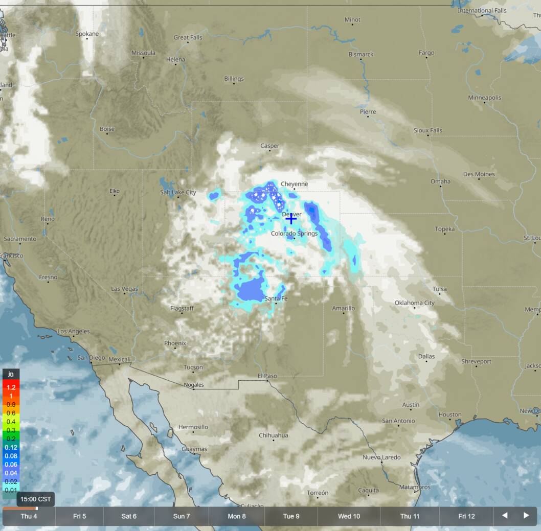
This is from the Meteoblue map of a system over Colorado today. Note the scale on the left hand side of the image. It is showing inches, as in inches per hour. NOT dBZ like radar. This is a forecast. Based on this, one could safely expect to see scattered light precipitation with some heavier snow to the north. Let’s look at the MSFS map.

Here, we can see scattered amounts of light precipitation with heavier regions to the north. It certainly looks very similar too, even on such a small scale. I think MSFS smooths out the graphics to make it look nicer. How about clouds?

The cloud cover looks even more similar, in my opinion. Cool. Let’s look at another system on Meteoblue.
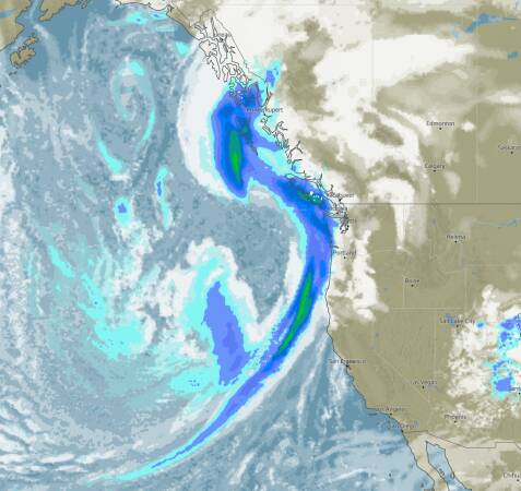
Again, these are precipitation RATES for a given spot over a period of one hour, not a NEXRAD forecast like you’d see on The Weather Channel. Now for MSFS…
Something you might be noticing is MSFS is more conservative with the shading and it seems like it’s smoothed out much more heavily. However, it’s clearly nearly identical. I won’t upload another picture for the clouds, but it was nearly spot on with Meteoblue, just as the other was.
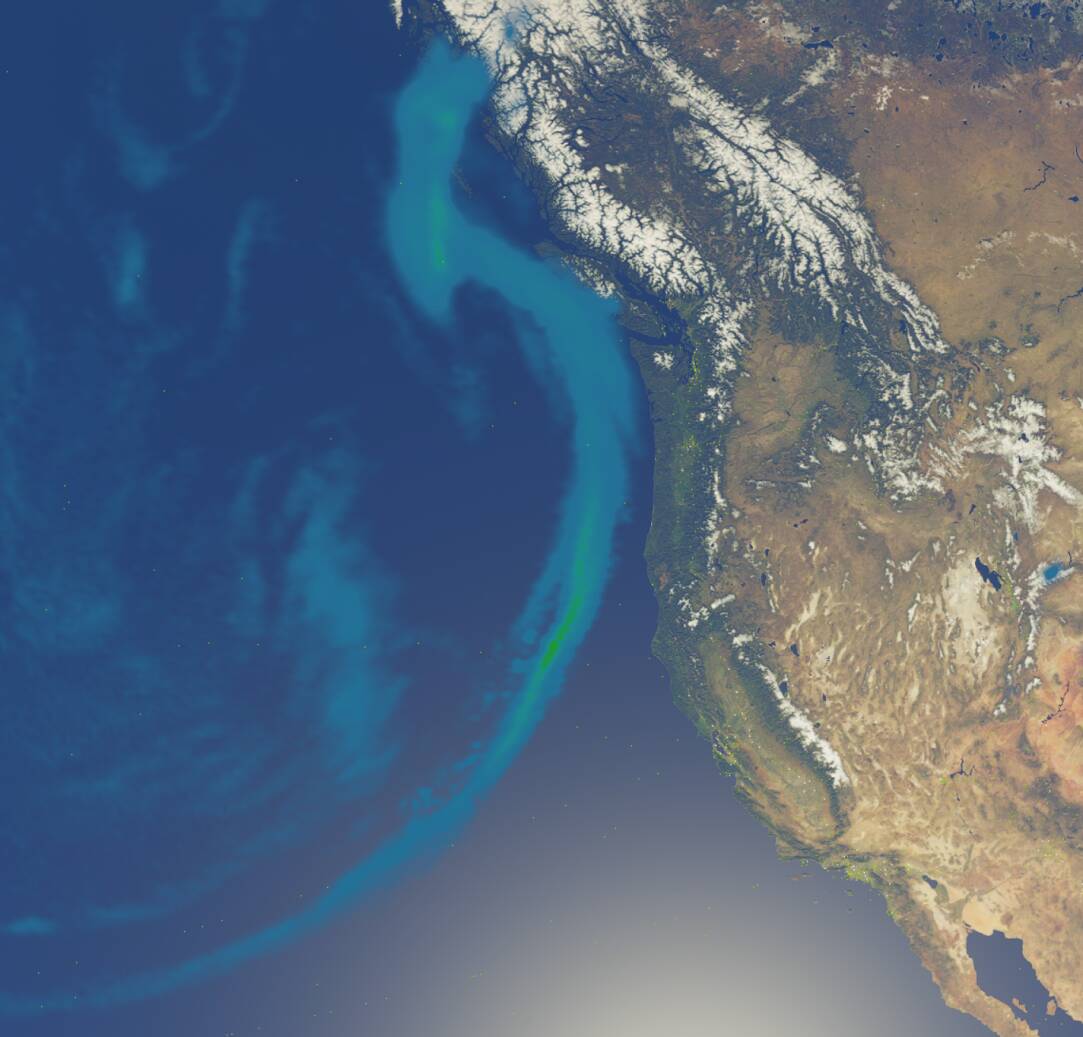
Let’s focus our attention on the Seattle area. Clicking on the Meteoblue map will give you what they call a Meteogram. Here’s one.

It’s showing blue bars for the precipitation rates, wind barbs, shading for clouds, temperature… Pretty neat! It’s a very broad overview of conditions Here, about 12PM PST, Meteoblue says there’ll be light rain and increasing cloud cover. And in MSFS…
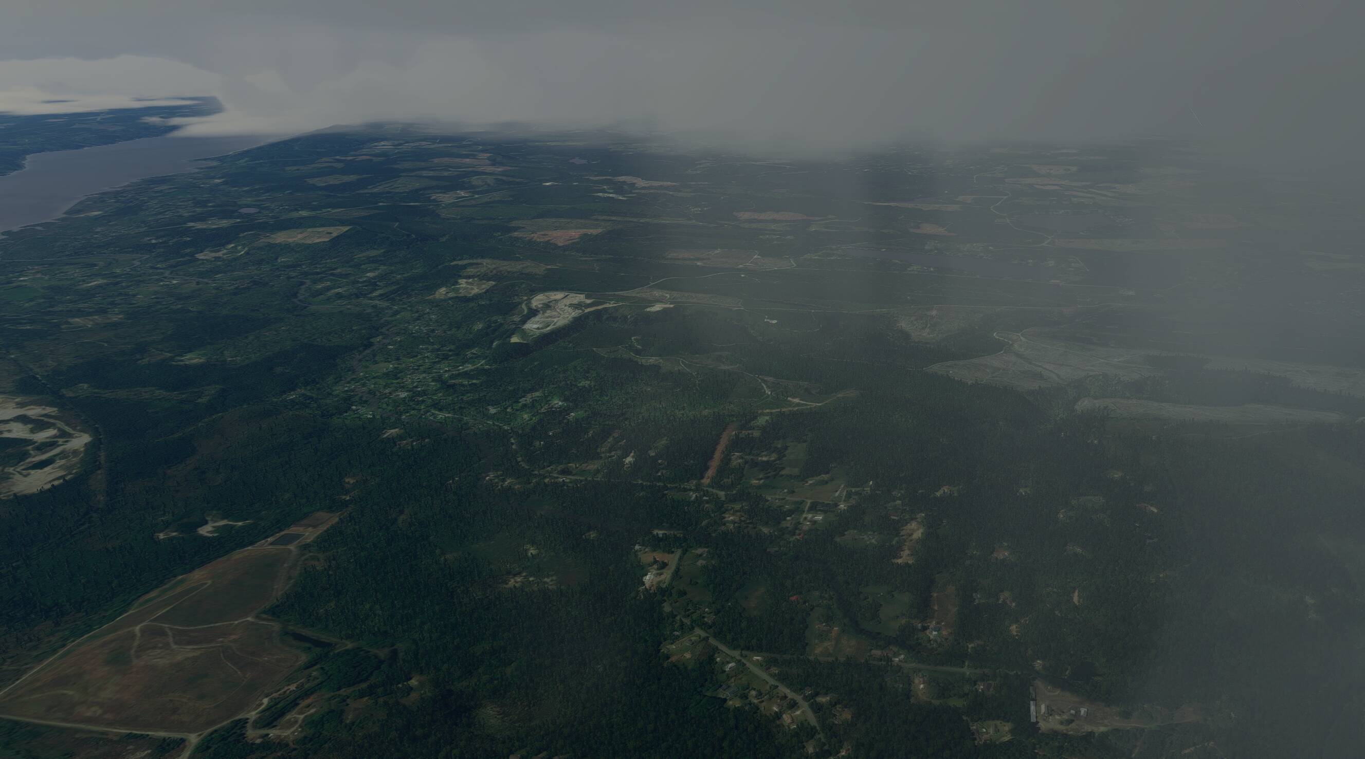
Higher overcast ceilings with some scattered clouds below. With this view looking west, we can even see those lower clouds moving into the area. Just like the Meteogram said.
In closing
Live weather in MSFS is dynamic. It is fluid. It is immersive. It changes, gets in your way, and makes for pretty screenshots. It’s also wrong sometimes. But, that’s okay. Once you can get over the hurdle of trying to figure out why your METAR isn’t matching up, things begin making much more sense.
REX and other METAR injection mods have their place for certain simmers, that’s true. But that isn’t to say the weather system in MSFS is totally broken, it just works differently. Things could be better, though. It’d be great to have a portal for METARs and TAFs as they are in-game. I’d love to have a CONUS Nexrad view of my flight route when planning.
The Meteoblue website can’t give you that for MSFS, but it will give you quite a lot more to work with if you understand what it has to offer.