All I can say is be cognizant of what you’re comparing the sim to.
I use Windy for my flight planning. Windy has many different layers for many different things. You want to check the sim against “forecast” data, NOT radar data or satellite data. Radar and satellite data are usually live observations and can be wildly different from the forecast data.
In Windy, I use the clouds layer, which is basically a depiction of the forecast model.
No, but there is something wrong here anyway, and relying only on “METAR” “reliability” is wrong anyway, because it doesn’t work.
The example from above in LOXT - in my opinion either the final solution is not “online” or it is a “bug” because:
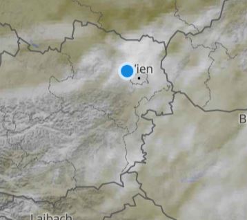
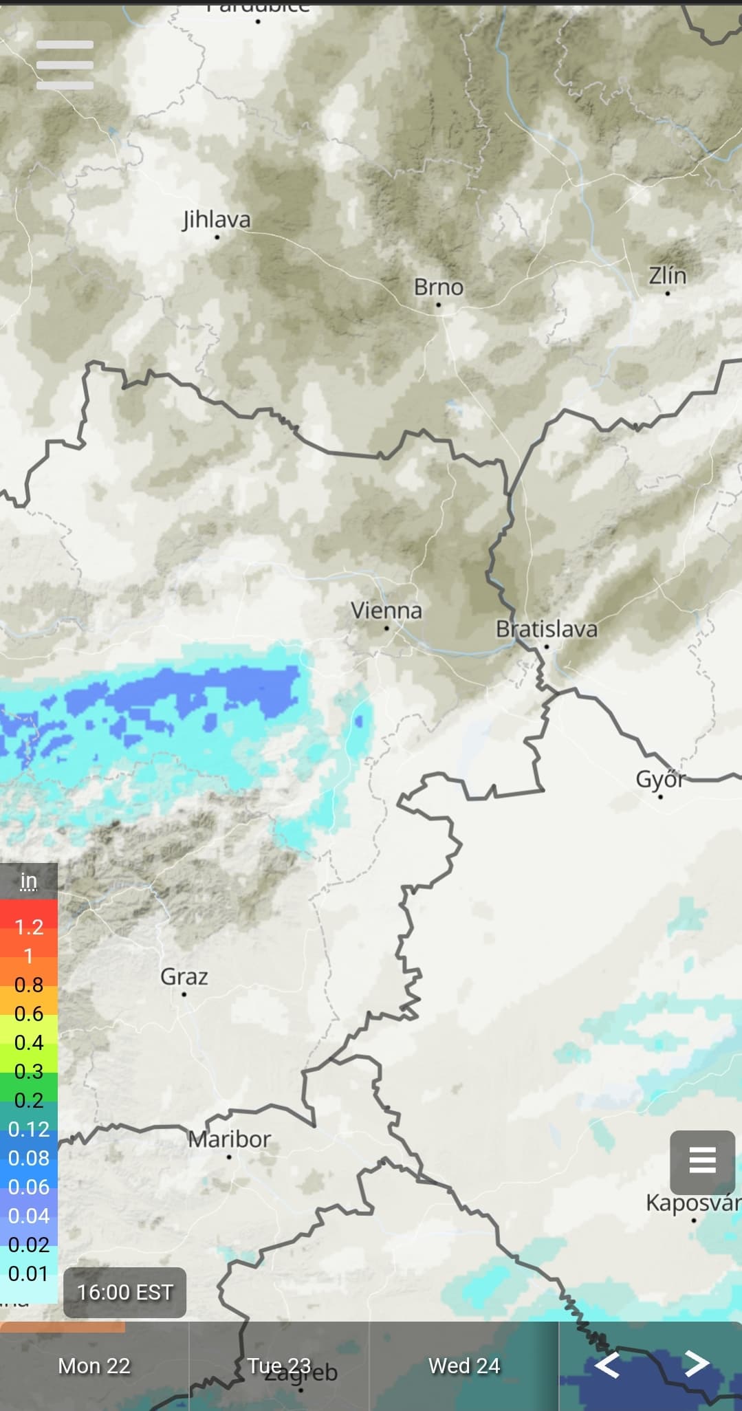
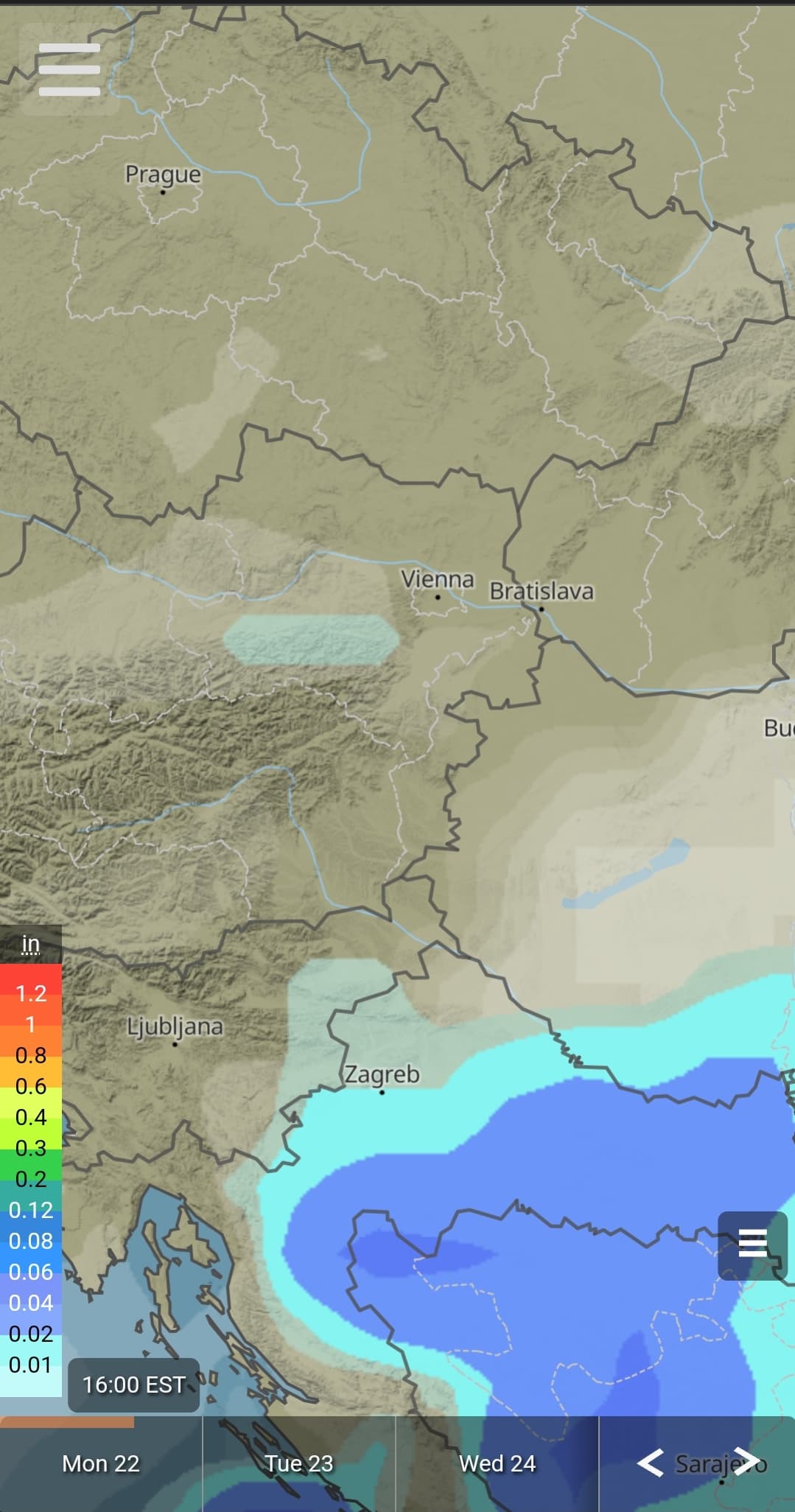
LOXT is not “online” at the moment (METAR) no values - the next station is LOWW - so forecast weather should be interpolated here: and according to METEOBLUE this is overcast which would also be correct on the satellite map (Meteoblue, it was anyway predicted)
But it is simply wrong, and this “puffy cumulus clouds” are also completely wrong - so I rather believe that ONLY METAR is “interpolated” here. And this will be true everywhere where there are no actual values!
And I’m pretty sure, if it was like this in the SU6, if there weren’t any significant deviations from the forecast like today, I would also see an overcast layer in the SIM (it was like that before) so I can say that what was presented somehow doesn’t work here.
I also think that the other problem is that MSFS seems to only know certain cloud types.
But the way I read it, we all want pretty much the same thing anyway - yes and we are all partly right, but I’ll wait and see what is coming now !
I have a subscription to Meteoblue and so check it against the very predictions/forecast that go into the sim, so my planning should be very, very accurate, as those sane forecasts should be what is injected into to the sim. The meteoblue model, I think I’m correct in saying, is not available on windy for, for example, low cloud.
This is what I’m seeing on Meteoblue. There seems to be a clear area before those stormy areas. Could LOWW currently be ahead of those storms in the sim?
EDIT: Also keep in mind Meteoblue also displays multiple weather models. I can’t say for sure but I think that the sim is provided the NEMS Global model, which currently shows this:
hmm, could be ,but I could not determine such differences before, compared to the “view out of the window” (anyway nonsense but as a comparison), of course it was not always accurate, it could be that MSFS shows these cumulus clouds instead of a “band of clouds”!
Before the release of MSFS it was advertised that this sim will revolutionise how weather will be displayed. Meteo Blue’s work was featured in detail in a Youtube clip, in which a guy from Meteo Blue explained their innovative system. They had developed an algorithm with which weather data could be calculated for any point on earth. These data had been used in MSFS to calculate the weather in between weather stations, which enabled a smooth transition and also a much more real looking environment than we have after SU7.
Has no one of you realized, that we do not have any high altitude clouds (high stratus or cirrus) anymore when using Live Weather? We now only have got cumulus and/or CBs or clear skies everywhere. I admit, they look stunning, but not real with all the blue sky in between them. This is, because it seems the metars used do not depict too many cloud layers or high altitude clouds.
The result is, we now have the same type of old fashioned weather we already had with FS 2004, except for the now better and stunning graphics.
check it in the sim again - no “cloud bands” approaching - (as we have already seen in the SU6!) - only this cumulus clouds, more or less !
But thank you ! BR !
at this point and more then a year into the sim, i’m tempted to just stop asking myself how this could have passed the QA if there’s even such a thing at Asobo (my guess more so at MS)?
Those walls along a cloud border have existed since the beginning and were also in the alpha versions. It’s due to the way clouds are designated by a grid over the earth. If there is a stark change from clouds to no clouds, you will see this wall along the cell partition in the grid. It’s really obvious when you get to the corner of a grid cell and the overcast clouds create a sharp 90 turn as they follow the cell boundary.
People in this thread are complaining about not having a smooth transition when the grid depiction method has been there since the beginning but is rarely seen due to the mixing of cloud types between cells.
When people say transition, they mean a sudden change in weather where the aircraft is, as it seems to occur when one transitions from one METAR ‘catchment area’ to another.