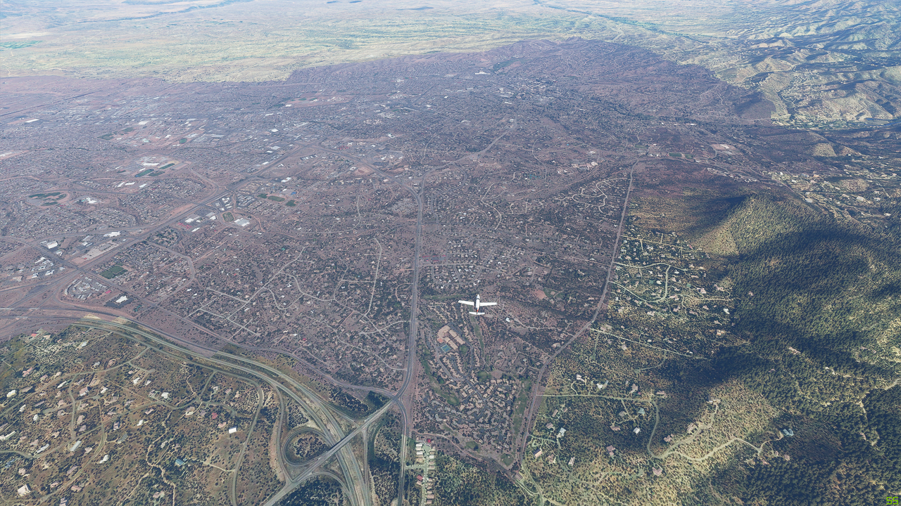
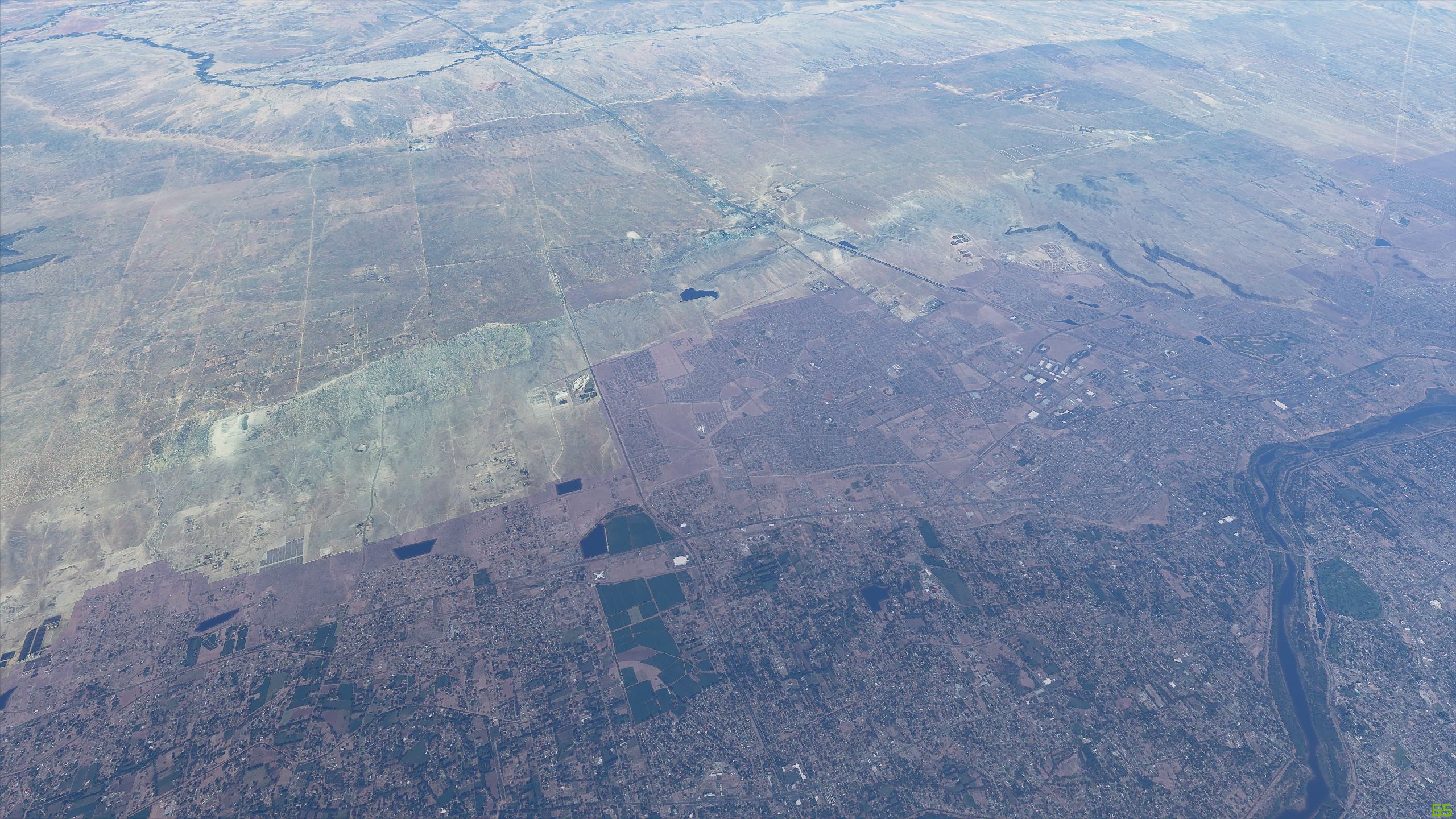
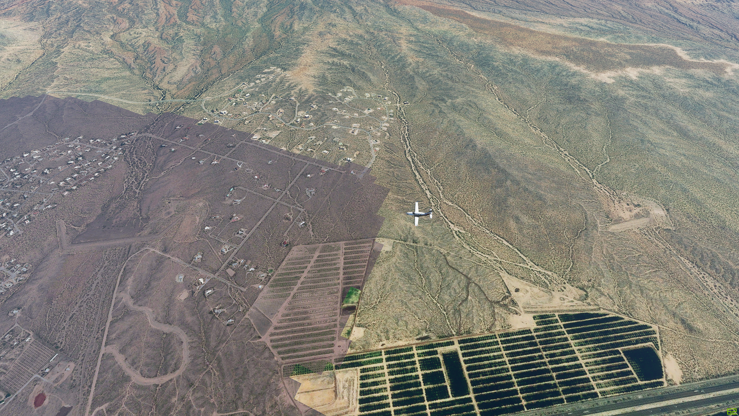
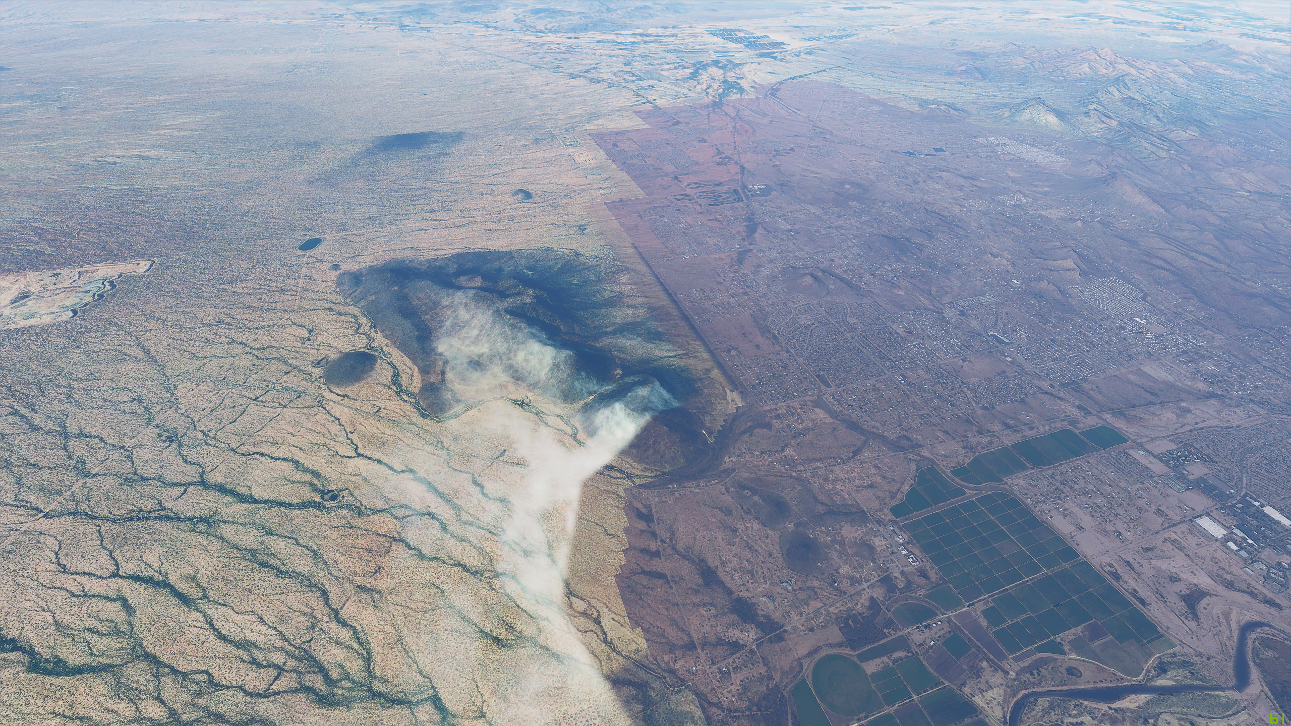
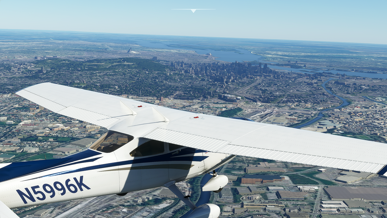
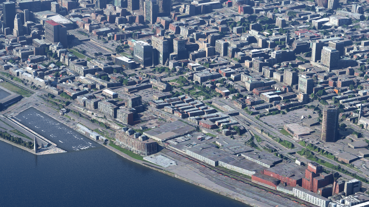
Photogrammetry is great, but it can produce quite “hard” borders where photogrammetry meets the normal scenery textures. Typically photogrammetry is darker and so stands out against lighter coloured surrounding scenery such as desert. Some examples:
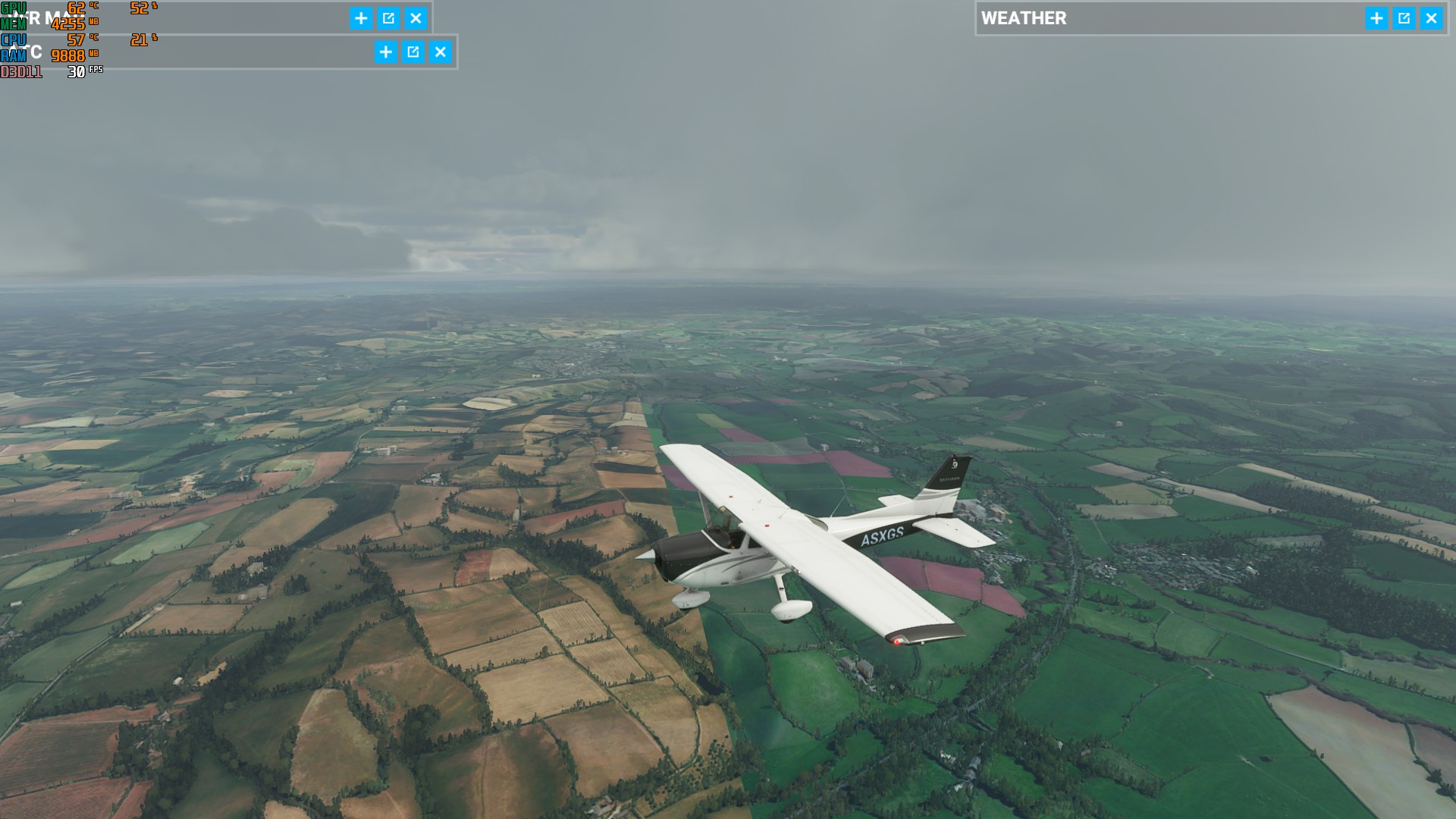
Is it a streaming bug or just the varying quality of Bing maps? I’ve found a few areas like this in the UK and didn’t notice it before the second patch, but maybe I flew a slightly different route. Any ideas?
The screenshots were taken different times but on both I changed the time of day in the weather drop down and still the same. It doesn’t seem to be related to the lighting the terrain is definitely not colour matched.
I checked on Bing maps and there seem to be many areas like this in the UK and as this is streamed to the sim I wondered if it will not be resolved until Bing update their data.
Yeah, but probably not always in a good way. I guess new bing data is always a possibility for introducing new straight lines caused by different season or time of day.
Yeah, I was using P3D with Orbx true earth. All their scenery is colour matched/corrected, I thought Bing would be the same.
I didn’t realise how much the quality varies until I started checking the areas on the Bing maps site.
It’s a shame as some areas look stunning but the experience at the moment is variable. Don’t get me wrong, I love the sim, an amazing achievement and I’m sure it will get better over time.
Perhaps they will adjust the colours of the data that they have, but it would be a massive undertaking.
I see those every once and a while and I put a Zendesk ticket with pix.
I think that Blackshark AI is what they use for getting the color matching done? Probably it still needs training to improve. I bet also will fix things like the green roads we see in some places?
If I’m not sadly mistaken, higher sat image resolution means better streamed scenery in the sim. They’d probably have to build a new server farm to hold global imagery at the highest possible resolution. And even at that, it would take so much time to map the entire globe in that resolution, that they’d have data years out of date when they were done.
I’m OK with the resolution of the terrain as it stands. I just hope they can sort out the colour differences so you don’t suddenly fly over an area that’s 10 shades lighter or half a field is brown and the other half deep green.
Perhaps I’m being too picky, my first flight sim was on the Commodore 64, a split green and blue screen and a black wavy line for the mountains
If BuffyFoster is correct and Blackshark is doing the colour matching then hopefully in time it will look better without any Bing updates.
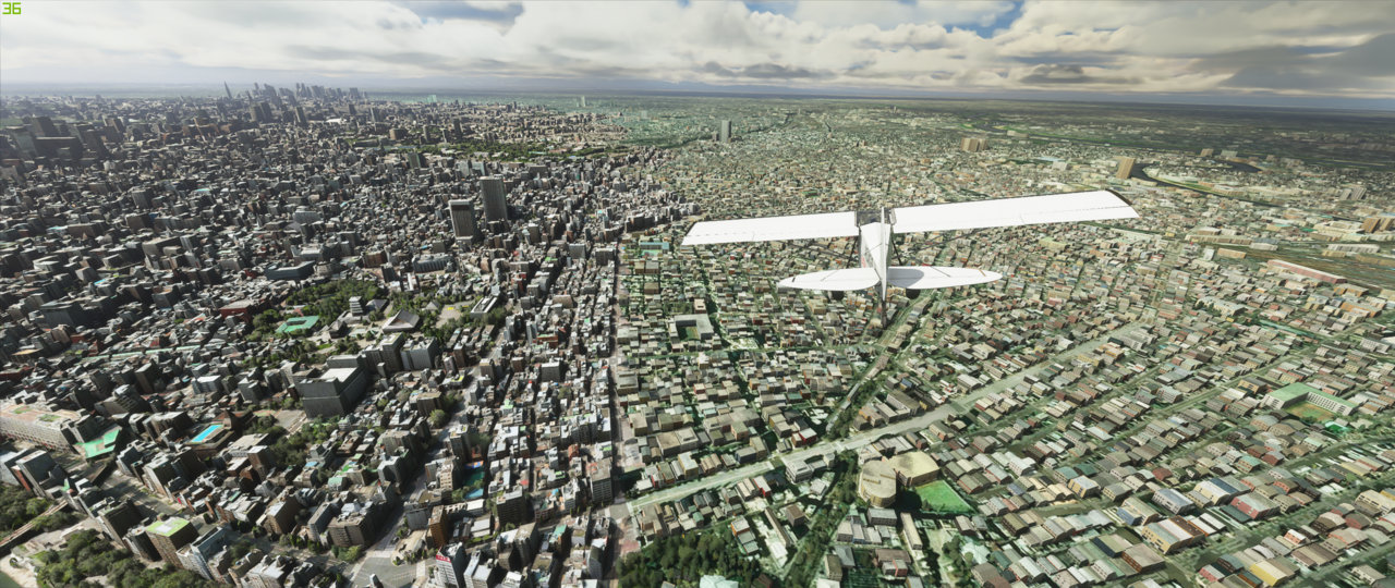
New photogrammetry data for Japan on the left. Previous autogen & OSM building data on the right by BlackShark.Ai.
Might want to consider a tiny bit of colour correction on rooftops and building materials to escape that green-tinge we see globally so objects visually blend together better. Not just a matter of photogrammetry having day-lit baked lighting data in the textures but also partially that existing building materials are a touch bit drab.
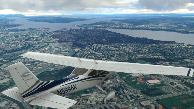
Photogrammy transition is usually accompanied by a colour change. An example can be seen here, which clearly shows the outline of the Photogrammy region:
The transition is jarring. Is it possible for the sim to automatically colour correct the transition to match the surrounding terrain?