I wish in-game VFR Map is updated to look more like real VFR Map (like one you access at skyvector.com website, World VFR). Current in-game VFR Map is really primitive.
Currently the VFR map is nearly useless. We would need a lot more information like circuit patterns, airspaces (to avoid entering special airspaces), min altitudes for given zones and more.
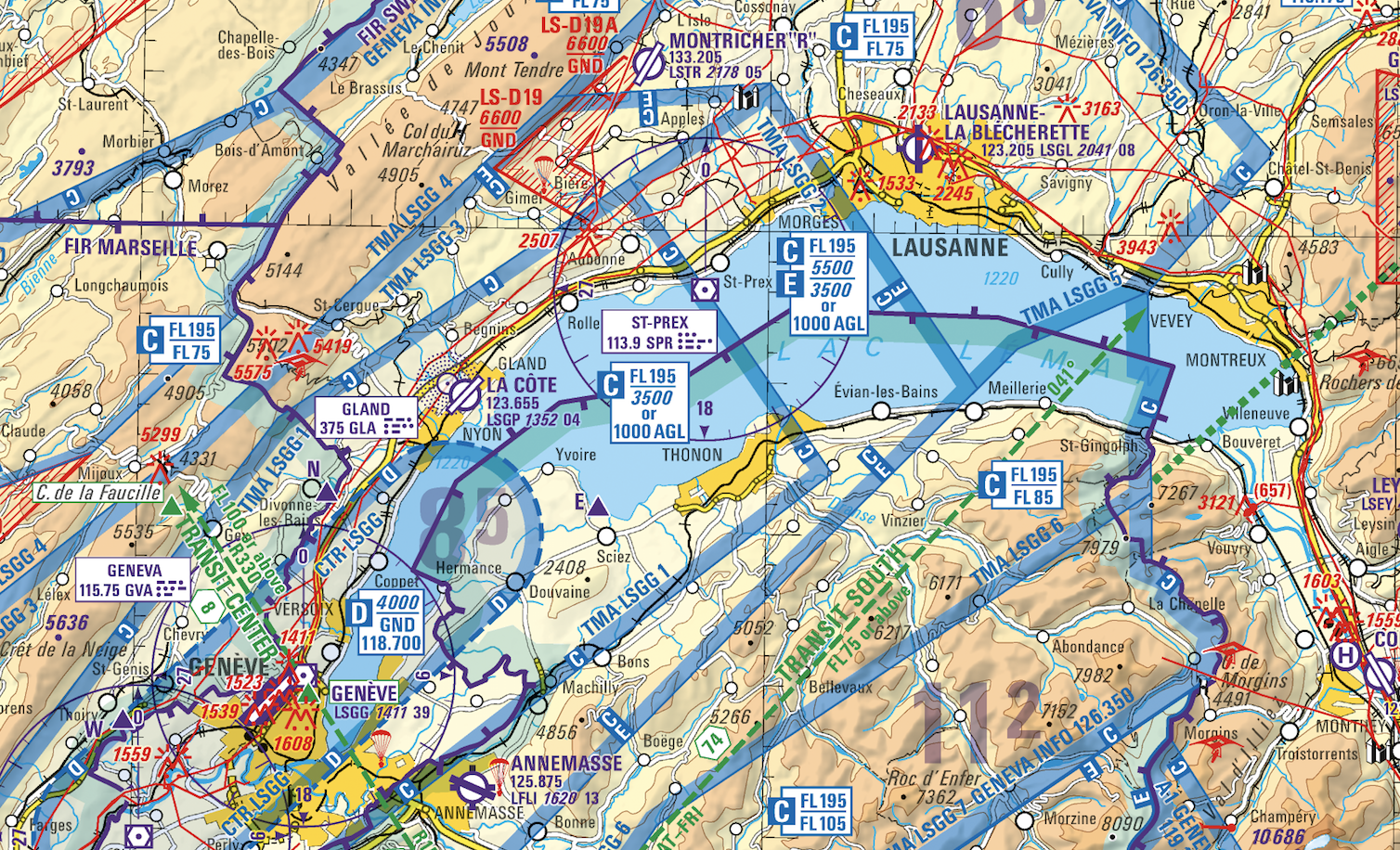
Example of the swiss (official) ICAO aeronautical map:
Or at least be like skyvector.com
14 Likes
I agree, this map thing makes me scratching my head - is this “VFR map” really all we got? Seriously? I wouldn expect a complete ICAO-style map but come on, something like in XP with switchable layers, airports information etc…why not??
1 Like
I would like to use the VFR map on an external display, but it’s essentially useless. It should allow you to:
- View airport/airspace information (runways, frequencies etc.)
- Have additional buttons to zoom in/out (so it can be used via touch screens)
- Provide at least rudimentary “IFR” view as well (maybe a toggle)
- This map and worldview should look similar
5 Likes
It’s super simple… Use the real thing on an iPad or Laptop beside you… Or… if you have 2 screens you don’t need an iPad or tablet or laptop. Just run the Win10 app in the same PC as the sim. Pull the EFB (Electronic Flight Bag) map to the second screen. Way cooler than the built in one. You can create the same flightplan in the EFB and use it in the sim or just VFR it and use the built in sim GPS’s in the plane like in RL.
WARNING: This is a real electronic flight bag capable of filing real flight plans. DO NOT ABUSE THIS PRODUCT!
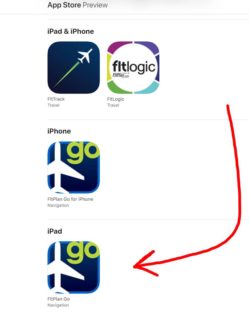
Fltplan GO - Google it. I cannot post links. Offers real time moving VFR/IFR Maps… Satalite and Road maps linked to the simulator.
It uses an app on your iPad and a little applet on your PC to connect to the simulator. If you do not have an iPad use the Win 10 app on your laptop beside you or a second screen and just run it there.
On the page there iPad, Andriod and Win10 versions of the Software.
Peace and love brothers and sisters. ![]()
PS - While the screenshots do not really show it… it is a real time moving map with your plane flying on the map with position updates from your simulator.
INSTRUCTIONS:
- Download the latest version of FltPlan Go for iOS, Android, or Windows.
- Make sure that the latest Service Pack is installed.
- Go to xxxxxxxxxxxxx (can’t post links - just google fltplan go instructions) to download the FltPlan Go GPS app on the computer that you plan to use with FSX or Prepar3D. <---- and MSFS2020
- After the file downloads, extract FSX.zip, run “setup.exe” and follow the
on-screen instructions.
a. For Steam users: Locate where you extracted FSX.zip & look for the folder
“Steam SDK”.
b. Inside this folder, you will find a file called “SimConnect.msi”.
c. Run SimConnect.msi and follow the on-screen instructions. - Open FSX or Prepar3D and enter your flight information.
- Before starting your flight in FSX or Prepar3D, open the FltPlan Go GPS file
press “Connect to FSX” and wait for it to connect.
a. Note: You will know that it is connected when it shows that messages are being
sent. - Open the FltPlan Go app on your device:
a. Go to the External tab
i. Select FSX & Prepare3D under Simulators.
ii. Wait until Status reads ‘Connected’.
b. Go to the Maps tab
i. In Maps Options: Make sure that Enable Ship Position and Toggle
Breadcrumbs are turned on. - You are all set to start your flight on FSX or Prepar3D and will see your
position on FltPlan Go.
C.


It already fails because “FltPlan Go” is not available in the AppStore (status of today).. ![]()
There’s this one which is pretty cool: FSPM VFR Map - A great MSFS toolbar mod with a moving map - MSFS Addons
Not sure why you don’t see it. I can search it on the App Store.
Search “fltplan(DOT)com”… this is what I see. Although I am in Canada? Maybe that’s an issue?
And I get it might be more complicated to use than other moving maps. This is if you want a real electronic flight bag tied to the sim but not pay a subscription for the other pro level products out there.
Is it possible to modify the current VFR and GPS maps by inserting a more realistic map like Bing or better yet VFR charts? The current ones are too unrealistic as they don’t show the names of towns and cities, and they don’t even show roads and railways. Flying in vfr is impossible like this. Only third-partyy mods should be used, which however, do not integrate with on-board GPS. Please of you want vote, thanks.
Greetings,
Fabio.
The GPS is fine. It’s more less how it looks in real life, so it is “realistic”. The VFR map is not really a VFR map, because it lacks any detail like terrain, obstacles, airspaces with limits, frequencies etc. It’s a toy. They should just call it “map” because it’s useless for both VFR and IFR.
This is an example what a VFR map should look like: https://www.airmate.aero/shop/wp-content/uploads/2019/08/Swisstopo-screenshot.png
They are talking about “charts” integration from NavBlue. So we can hope someday it will get better. Right now it’s just a placeholder.
3 Likes
You can install the Working Title G1000 mod to make the G1000 and G3X at least a lot more realistic:
For the GNS530 you can install this mod:
I want to say somthing like this:

I agree with you for VFR map.
1 Like
Use mods. It’s much better than stock. For starters the workingtitle ones.
2 Likes
BTW - the best way to have a proper VFR map is to use little nav map. Use the topo map and it looks very solid.
There a even mods to have it as a panel inside the game. Perfect for VR.
2 Likes
There are also a bunch of mods for alternative integrated vfr maps, just use the search function in the forum to find them
I know there are lot of mod to do this, but I want to say if Asobo team can in a future update, upgrade the integrated VFR map in the sim, without the use of other mods. Mine Is a request to Asobo.
2 Likes
Little nav map works well.
Another good option is the free Mobile Companion App that has a batch of features one of which is a map feature with various map options you can display on the browser of ANY other phone/pad/other device that is on the same network as your PC (or on the PC itself if you want).
being able to sit your phone in front of the keyboard with a moving map displayed on the phones browser is very handy.
3 Likes